
 Puerto de la Duquesa
La Serna de Iguña
Pumalverde
Puentenansa
La Iglesia
Casar de Periedo
Fuengirola
Renedo de Piélagos
Villabanez
Puerto de la Duquesa
La Serna de Iguña
Pumalverde
Puentenansa
La Iglesia
Casar de Periedo
Fuengirola
Renedo de Piélagos
Villabanez
Senda fluvial de Mondariz-Balneario on the map, Ponteareas, Spain
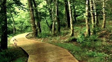
Photo
Where is located Senda fluvial de Mondariz-Balneario
Senda fluvial de Mondariz-Balneario — local attraction, which is located at 36890 Mondariz – Balneario, Pontevedra, Spain and belongs to the category — hiking area. Average visitor rating for this place — 4.7 (according to 69 ratings, information from open sources and relevant for 2022).
Exact location — Senda fluvial de Mondariz-Balneario, marked on the map with a red marker.
You can get directions to Senda fluvial de Mondariz-Balneario on the map from your location.
What else is interesting in Ponteareas? You can see all the sights if you go to the city page.
Coordinates
Senda fluvial de Mondariz-Balneario, Spain coordinates in decimal format: latitude — 42.22817352928801, longitude — -8.46854402499844. When converted to degrees, minutes, seconds Senda fluvial de Mondariz-Balneario has the following coordinates: 42°13′41.42 north latitude and -8°28′6.76 east longitude.
Nearby cities
The largest cities that are located nearby:
- Vigo — 19 km
- Ourense — 55 km
- Braga
 (Portugal) — 70 km
 - Porto (Portugal) — 113 km
- A Coruña — 131 km
- Coimbra (Portugal) — 218 km
- León — 244 km
- Oviedo — 251 km
- Salamanca — 272 km
- Gijón — 273 km
- Valladolid — 318 km
- Amadora (Portugal) — 383 km
- Queluz (Portugal) — 383 km
- Lisbon (Portugal) — 386 km
- Badajoz — 388 km
- Burgos — 393 km
- Santander — 403 km
- Móstoles — 441 km
- Alcorcón — 443 km
Distance to the capital
Distance to the capital (Madrid) is about — 446 km.