Jaci — Parintins
Jaci — Matozinhos
Jaci — Gurupi
Jaci — Portão
Jaci — International Airport of Brasilia
Jaci — Apiaí
Jaci — São Vicente
Jaci — Itaú
Jaci — Barão de Cocais
Jaci — Itupeva
Jaci — Taiobeiras
Jaci — Aquiraz
Jaci — Laguna
Jaci — Dumont
Jaci — Petrópolis
Jaci — Otacílio Costa
Jaci — Marilândia do Sul
Jaci — Guanta
Jaci — Gabriel Monteiro
Penápolis
Clementina
Piacatu
Osvaldo Cruz
Sagres
Regente Feijó
Presidente Prudente
Álvares Machado
Presidente Bernardes
Santo Anastácio
Piquerobi
Presidente Venceslau
Presidente Epitácio
Bataguassu
Nova Alvorada do Sul
Rio Brilhante
Maracaju
Guia Lopes da Laguna
Jaci — Bonito distance, route on the map
Distance by car
Distance between Jaci, São Paulo, Brazil and Bonito, Mato Grosso do Sul, Brazil by car is — km, or miles. To travel this distance by car, you need minute, or h.
Route on the map, driving directions
Car route Jaci — Bonito was created automatically. The road on the map is shown as a blue line. By moving the markers, you can create a new route through the points you need.
Passing cities through which the car route passes: José Bonifácio, Penápolis, Clementina, Piacatu, Osvaldo Cruz, Sagres, Regente Feijó, Presidente Prudente, Álvares Machado, Presidente Bernardes, Santo Anastácio, Piquerobi, Presidente Venceslau, Presidente Epitácio, Bataguassu, Nova Alvorada do Sul, Rio Brilhante, Maracaju, Guia Lopes da Laguna.
Distance by plane
If you decide to take a trip Jaci Bonito by plane, then you have to fly the distance — 718 km or 445 miles. It is marked on the map with a gray line (between two points in a straight line).
Flight time
Estimated flight time Jaci Bonito by plane at cruising speed 750 km / h will be — 57 min.
Direction of movement
Brazil, Jaci — right-hand traffic. Brazil, Bonito — right-hand traffic.
Difference in time
Jaci and Bonito are in different time zones. The time difference is 1 hour (UTC -3 America/Sao_Paulo, UTC -4 America/Campo_Grande).
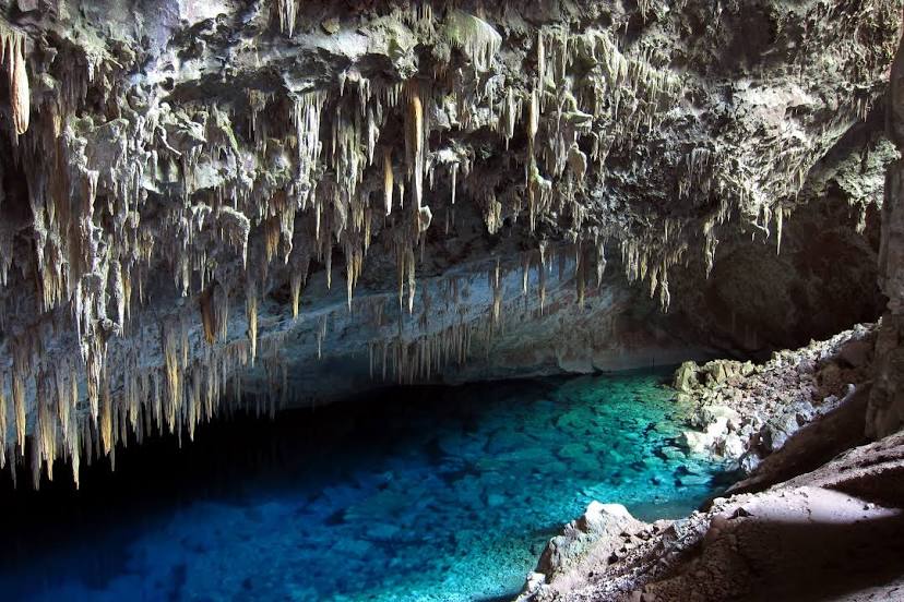
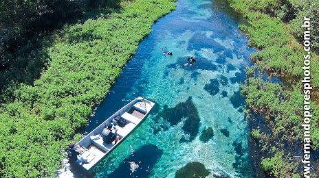
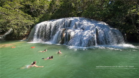
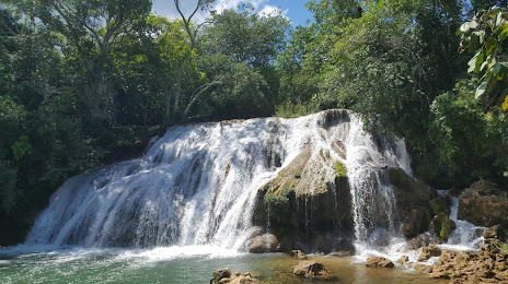
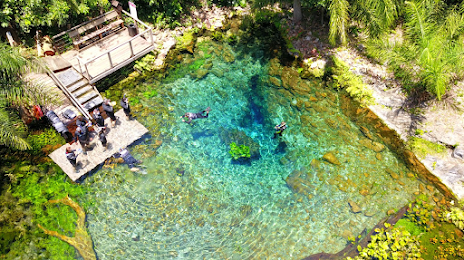
Interesting Facts
Information on alternative ways to get to your destination.
The length of this distance is about 1.8% of the total length of the equator.
The percentage of the population is clearly shown in the graph:
Jaci — 3,272 (less by 11,232), Bonito — 14,504 residents.
The cost of travel
Calculate the cost of the trip yourself using the fuel consumption calculator, changing the data in the table.