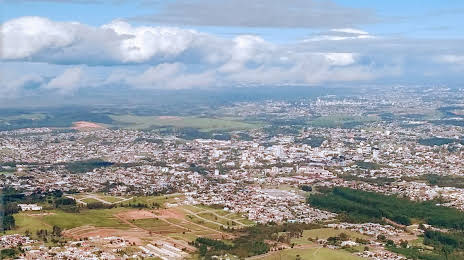
Monte Castelo — Jundiá
Monte Castelo — Quissamã
Monte Castelo — Pau Brasil
Monte Castelo — Rio Preto da Eva
Monte Castelo — Chopinzinho
Monte Castelo — Pelotas
Monte Castelo — Heliodora
Monte Castelo — Farias Brito
Monte Castelo — Espera Feliz
Monte Castelo — Cruz Machado
Monte Castelo — Porto Franco
Monte Castelo — Santa Maria Madalena
Monte Castelo — Itaueira
Monte Castelo — São Mateus do Sul
Monte Castelo — Piraju
Monte Castelo — Helicóptero
Monte Castelo — Santo Amaro das Brotas
Monte Castelo — Patos
Monte Castelo — Jaguaré
Santa Cecília
Correia Pinto
Lages
Lages
Capão Alto
Vacaria
Antônio Prado
Flores da Cunha
Caxias do Sul
Caxias do Sul Regional Airport
Farroupilha
Feliz
Bom Princípio
São Sebastião do Caí
Capela de Santana
Portão
São Leopoldo
Novo Hamburgo
Novo Hamburgo
Monte Castelo — Campo Bom distance, route on the map
Distance by car
Distance between Monte Castelo, Santa Catarina, Brazil and Campo Bom, Rio Grande do Sul, Brazil by car is — km, or miles. To travel this distance by car, you need minute, or h.
Route on the map, driving directions
Car route Monte Castelo — Campo Bom was created automatically. The road on the map is shown as a blue line. By moving the markers, you can create a new route through the points you need.
Passing cities through which the car route passes: Residência Fuck, Santa Cecília, Correia Pinto, Lages, Lages, Capão Alto, Vacaria, Antônio Prado, Flores da Cunha, Caxias do Sul, Caxias do Sul Regional Airport, Farroupilha, Feliz, Bom Princípio, São Sebastião do Caí, Capela de Santana, Portão, São Leopoldo, Novo Hamburgo, Novo Hamburgo.
Distance by plane
If you decide to take a trip Monte Castelo Campo Bom by plane, then you have to fly the distance — 367 km or 228 miles. It is marked on the map with a gray line (between two points in a straight line).
Flight time
Estimated flight time Monte Castelo Campo Bom by plane at cruising speed 750 km / h will be — 29 min.
Direction of movement
Brazil, Monte Castelo — right-hand traffic. Brazil, Campo Bom — right-hand traffic.
Difference in time
Monte Castelo and Campo Bom are in the same time zone. Between them there is no time difference (UTC -3 America/Sao_Paulo).
Interesting Facts
Information on alternative ways to get to your destination.
The length of this distance is about 0.9% of the total length of the equator.
The percentage of the population is clearly shown in the graph:
Monte Castelo — 8,135 (less by 46,627), Campo Bom — 54,762 residents.
The cost of travel
Calculate the cost of the trip yourself using the fuel consumption calculator, changing the data in the table.