
 San Antonio de Arredondo
Selva
Colonia Santa Rosa
Punta Lara
Coronel Mom
Puerto Gaboto
Dos de Mayo
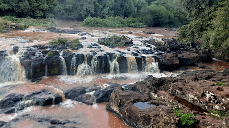
Montecarlo
Santa Clara de Saguier
Los Cisnes
Bandera
Tolhuin
Charras
Ausonia
La Angelita
Virginia
Beltrán
Salto Grande
Trenel
San Antonio de Arredondo
Selva
Colonia Santa Rosa
Punta Lara
Coronel Mom
Puerto Gaboto
Dos de Mayo
Montecarlo
Santa Clara de Saguier
Los Cisnes
Bandera
Tolhuin
Charras
Ausonia
La Angelita
Virginia
Beltrán
Salto Grande
Trenel
Jardín América on the map, Argentina
Where is located Jardín América
Exact location — Jardín América, San Ignacio, Misiones Province, Argentina, marked on the map with a red marker.
Coordinates
Jardín América, Argentina coordinates in decimal format: latitude — -27.0431973, longitude — -55.2270686. When converted to degrees, minutes, seconds Jardín América has the following coordinates: -27°2′35.51 north latitude and -55°13′37.45 east longitude.
Population
Jardín América, San Ignacio, Misiones Province, Argentina, according to our data the population is — 24,905 residents, which is about 0.1% of the total population of the country (Argentina).
Comparison of the population on the graph:
Exact time
Time zone for this location Jardín América — UTC -3 America/Cordoba. Exact time — saturday, 5 may 2024 year, 03 h. 49 minutes.
Sunrise and sunset
Jardín América, sunrise and sunset data for a date — saturday 18.05.2024.
| Sunrise | Sunset | Day (duration) |
|---|---|---|
| 07:18 +1 minute | 17:56 -0 minutes | 10 h. 36 minutes. -1 minute |
You can control the scale of the map using the auxiliary tools to find out exactly where it is located Jardín América. When you change the scale of the map, the width of the ruler also changes (in kilometers and miles).
Nearby cities
The largest cities that are located nearby:
- Posadas — 75 km
- Ciudad del Este
 (Paraguay) — 179 km
 - Foz do Iguaçu
 (Brazil) — 181 km
 - Chapecó (Brazil) — 257 km
- Capiata (Paraguay) — 289 km
- Cascavel (Brazil) — 291 km
- San Lorenzo (Paraguay) — 297 km
- Luque (Paraguay) — 299 km
- Fernando De La Mora (Paraguay) — 300 km
- Lambare (Paraguay) — 303 km
- Passo Fundo (Brazil) — 305 km
- Formosa — 308 km
- Asuncion (Paraguay) — 310 km
- Santa Maria (Brazil) — 322 km
- Uruguaiana (Brazil) — 350 km
- Corrientes — 358 km
- Resistencia — 372 km
- Santa Cruz do Sul (Brazil) — 400 km
- Guarapuava (Brazil) — 418 km
Distance to neighboring capitals:
- Asuncion (Paraguay) — 307 km
- Asuncion (Paraguay) — 310 km
- Montevideo
 (Uruguay) — 879 km
 - Santiago
 (Chile) — 1641 km
 - Nuestra Señora de La Paz
 (Bolivia) — 1774 km
 - Bogota
 (Colombia) — 4061 km
 - Caracas
 (Venezuela) — 4365 km
Attractions
Distance to the capital
Distance to the capital (Buenos Aires) is about — 893 km.