
 Puerto de la Duquesa
La Serna de Iguña
Pumalverde
Puentenansa
La Iglesia
Casar de Periedo
Fuengirola
Renedo de Piélagos
Villabanez
Puerto de la Duquesa
La Serna de Iguña
Pumalverde
Puentenansa
La Iglesia
Casar de Periedo
Fuengirola
Renedo de Piélagos
Villabanez
Paseo Maritimo Carril-Vilagarcia De Arousa on the map, Vilagarcía de Arousa, Spain
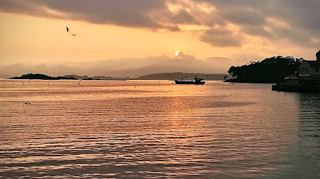
Photo
Where is located Paseo Maritimo Carril-Vilagarcia De Arousa
Paseo Maritimo Carril-Vilagarcia De Arousa — local attraction, which is located at no data and belongs to the category — -. Average visitor rating for this place — 4.5 (according to 319 ratings, information from open sources and relevant for 2022).
Exact location — Paseo Maritimo Carril-Vilagarcia De Arousa, marked on the map with a red marker.
You can get directions to Paseo Maritimo Carril-Vilagarcia De Arousa on the map from your location.
What else is interesting in Vilagarcía de Arousa? You can see all the sights if you go to the city page.
Coordinates
Paseo Maritimo Carril-Vilagarcia De Arousa, Spain coordinates in decimal format: latitude — 42.607776694330084, longitude — -8.769229410665256. When converted to degrees, minutes, seconds Paseo Maritimo Carril-Vilagarcia De Arousa has the following coordinates: 42°36′28 north latitude and -8°46′9.23 east longitude.
Nearby cities
The largest cities that are located nearby:
- Vigo — 39 km
- Ourense — 79 km
- A Coruña — 89 km
- Braga
 (Portugal) — 119 km
 - Porto (Portugal) — 159 km
- Oviedo — 249 km
- León — 260 km
- Coimbra (Portugal) — 266 km
- Gijón — 270 km
- Salamanca — 315 km
- Valladolid — 350 km
- Santander — 409 km
- Burgos — 415 km
- Amadora (Portugal) — 426 km
- Queluz (Portugal) — 426 km
- Lisbon (Portugal) — 429 km
- Badajoz — 439 km
- Bilbao — 475 km
- Móstoles — 483 km
Distance to the capital
Distance to the capital (Madrid) is about — 487 km.