
 Puerto de la Duquesa
La Serna de Iguña
Pumalverde
Puentenansa
La Iglesia
Casar de Periedo
Fuengirola
Renedo de Piélagos
Villabanez
Puerto de la Duquesa
La Serna de Iguña
Pumalverde
Puentenansa
La Iglesia
Casar de Periedo
Fuengirola
Renedo de Piélagos
Villabanez
Ría de Ares on the map, Sada, Spain
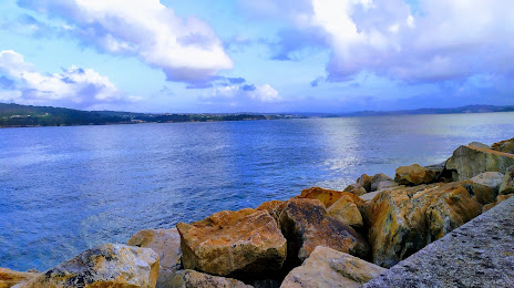
Photo
Where is located Ría de Ares
Ría de Ares — local attraction, which is located at Spain and belongs to the category — -. Average visitor rating for this place — 4.8 (according to 17 ratings, information from open sources and relevant for 2022).
Exact location — Ría de Ares, marked on the map with a red marker.
You can get directions to Ría de Ares on the map from your location.
What else is interesting in Sada? You can see all the sights if you go to the city page.
Coordinates
Ría de Ares, Spain coordinates in decimal format: latitude — 43.3657415327782, longitude — -8.244158581612975. When converted to degrees, minutes, seconds Ría de Ares has the following coordinates: 43°21′56.67 north latitude and -8°14′38.97 east longitude.
Nearby cities
The largest cities that are located nearby:
- A Coruña — 13 km
- Ourense — 117 km
- Vigo — 129 km
- Oviedo — 193 km
- Braga
 (Portugal) — 201 km
 - Gijón — 209 km
- León — 234 km
- Porto (Portugal) — 245 km
- Salamanca — 341 km
- Valladolid — 347 km
- Coimbra (Portugal) — 349 km
- Santander — 357 km
- Burgos — 389 km
- Bilbao — 429 km
- Vitoria-Gasteiz — 455 km
- Logroño — 484 km
- Alcobendas — 498 km
- Móstoles — 499 km
- Alcorcón — 500 km
Distance to the capital
Distance to the capital (Madrid) is about — 499 km.