
 Maureville
Samoëns
Gréning
Toulouse
Volx
Goudet
Méhoncourt
Saint-Hymer
Pontcarré
Maureville
Samoëns
Gréning
Toulouse
Volx
Goudet
Méhoncourt
Saint-Hymer
Pontcarré
Parc de Maisons-Laffitte on the map, Sartrouville, France
Photo
Where is located Parc de Maisons-Laffitte
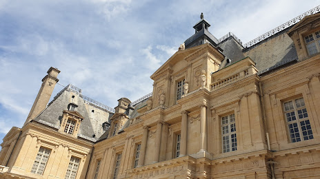
Parc de Maisons-Laffitte — local attraction, which is located at 13 Av. Cuvier, 78600 Maisons-Laffitte, France and belongs to the category — city park. Average visitor rating for this place — 4.8 (according to 34 ratings, information from open sources and relevant for 2022).
Exact location — Parc de Maisons-Laffitte, marked on the map with a red marker.
You can get directions to Parc de Maisons-Laffitte on the map from your location.
What else is interesting in Sartrouville? You can see all the sights if you go to the city page.
Coordinates
Parc de Maisons-Laffitte, France coordinates in decimal format: latitude — 48.9471135445251, longitude — 2.1502059793515955. When converted to degrees, minutes, seconds Parc de Maisons-Laffitte has the following coordinates: 48°56′49.61 north latitude and 2°9′0.74 east longitude.
Nearby cities
The largest cities that are located nearby:
- Boulogne-Billancourt — 13 km
- Rouen — 94 km
- Amiens — 106 km
- Orléans — 116 km
- Reims — 140 km
- Le Havre — 159 km
- Le Mans — 178 km
- Caen — 185 km
- Lille — 197 km
- Tours — 204 km
- Charleroi
 (Belgium) — 229 km
 - Eastbourne
 (United Kingdom) — 241 km
 - Namur (Belgium) — 255 km
- Angers — 260 km
- Brussels (Belgium) — 261 km
- Dijon — 281 km
- Crawley (United Kingdom) — 290 km
- Metz — 291 km
- Gillingham (United Kingdom) — 292 km
Distance to the capital
Distance to the capital (Paris) is about — 18 km.