
 Bel-Ha
San Jose El Alto
El Porvenir
Nueva Palestina
Santa Lucía
Chemax
La Morita
Temoac
Zacualpan
Bel-Ha
San Jose El Alto
El Porvenir
Nueva Palestina
Santa Lucía
Chemax
La Morita
Temoac
Zacualpan
Parque Tacana Extremo on the map, Tapachula, Mexico
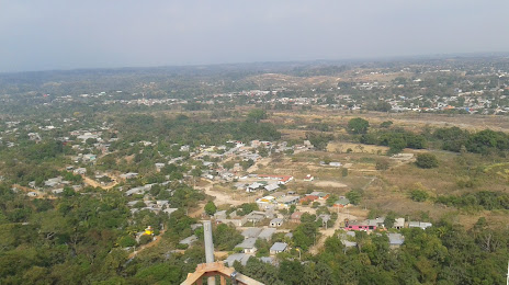
Photo
Where is located Parque Tacana Extremo
Parque Tacana Extremo — local attraction, which is located at San Isidro, Las Delicias, 30735 Tapachula de Córdova y Ordoñez, Chis., Mexico and belongs to the category — park. Average visitor rating for this place — 3.7 (according to 18 ratings, information from open sources and relevant for 2022).
Exact location — Parque Tacana Extremo, marked on the map with a red marker.
You can get directions to Parque Tacana Extremo on the map from your location.
What else is interesting in Tapachula? You can see all the sights if you go to the city page.
Coordinates
Parque Tacana Extremo, Mexico coordinates in decimal format: latitude — 14.931508656740455, longitude — -92.27047787570093. When converted to degrees, minutes, seconds Parque Tacana Extremo has the following coordinates: 14°55′53.43 north latitude and -92°16′13.72 east longitude.
Nearby cities
The largest cities that are located nearby:
- Quetzaltenango
 (Guatemala) — 80 km
 - Escuintla (Guatemala) — 172 km
- San Juan Sacatepéquez (Guatemala) — 174 km
- Villa Nueva (Guatemala) — 184 km
- Guatemala City (Guatemala) — 188 km
- Villa Canales (Guatemala) — 193 km
- San Cristóbal de las Casas — 206 km
- Tuxtla Gutiérrez — 223 km
- Santa Ana
 (El Salvador) — 307 km
 - Santa Tecla (El Salvador) — 347 km
- Villahermosa — 348 km
- Mejicanos (El Salvador) — 352 km
- Apopa (El Salvador) — 353 km
- San Salvador (El Salvador) — 354 km
- Soyapango (El Salvador) — 361 km
- Minatitlán — 417 km
- Ciudad del Carmen — 417 km
- Coatzacoalcos — 425 km
- San Pedro Sula
 (Honduras) — 455 km
Distance to the capital
Distance to the capital (Mexico City) is about — 884 km.