 Warner Robins
Wantagh
Bethel
Misty Hill Farm
United States
Wakonda Beach (R33) Airport
Wilmington
Poland
Miami International Airport
Warner Robins
Wantagh
Bethel
Misty Hill Farm
United States
Wakonda Beach (R33) Airport
Wilmington
Poland
Miami International Airport
W G Jones State Forest on the map, The Woodlands, United States
Photo
Where is located W G Jones State Forest
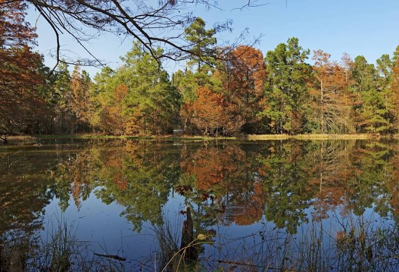
W G Jones State Forest — local attraction, which is located at 1328 Farm to Market Rd 1488, Conroe, TX 77384, United States and belongs to the category — state park. Average visitor rating for this place — 4.7 (according to 833 ratings, information from open sources and relevant for 2022).
Exact location — W G Jones State Forest, marked on the map with a red marker.
You can get directions to W G Jones State Forest on the map from your location.
What else is interesting in The Woodlands? You can see all the sights if you go to the city page.
Coordinates
W G Jones State Forest, United States coordinates in decimal format: latitude — 30.234700834863226, longitude — -95.48258532542555. When converted to degrees, minutes, seconds W G Jones State Forest has the following coordinates: 30°14′4.92 north latitude and -95°28′57.31 east longitude.
Nearby cities
The largest cities that are located nearby:
- Houston — 45 km
- Beaumont — 129 km
- Austin — 217 km
- Waco — 220 km
- Killeen — 238 km
- San Antonio — 302 km
- Mesquite — 307 km
- Shreveport — 307 km
- Dallas — 314 km
- Grand Prairie — 319 km
- Corpus Christi — 322 km
- Arlington — 323 km
- Garland — 323 km
- Irving — 324 km
- Richardson — 330 km
- Lafayette — 330 km
- Fort Worth — 335 km
- Plano — 336 km
- Carrollton — 338 km
Distance to the capital
Distance to the capital (Washington) is about — 1940 km.