
 Józefów nad Wisłą
Gorzyce Wielkie
Rogówek
Sromowce Niżne
Wyszków County
Kruszewo
Jantar
Sady Górne
Nagoszewo
Józefów nad Wisłą
Gorzyce Wielkie
Rogówek
Sromowce Niżne
Wyszków County
Kruszewo
Jantar
Sady Górne
Nagoszewo
Muzeum Regionalne w Lubaniu on the map, Luban, Poland
Photo
Where is located Muzeum Regionalne w Lubaniu
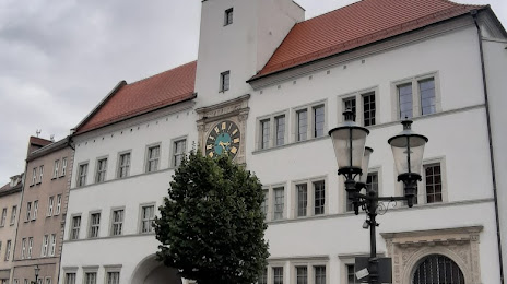
Muzeum Regionalne w Lubaniu — local attraction, which is located at Rynek Ratusz, 59-800 Lubań, Poland and belongs to the category — museum. Average visitor rating for this place — 4.6 (according to 9 ratings, information from open sources and relevant for 2022).
Exact location — Muzeum Regionalne w Lubaniu, marked on the map with a red marker.
You can get directions to Muzeum Regionalne w Lubaniu on the map from your location.
What else is interesting in Luban? You can see all the sights if you go to the city page.
Coordinates
Muzeum Regionalne w Lubaniu, Poland coordinates in decimal format: latitude — 51.11979407465905, longitude — 15.289456825305134. When converted to degrees, minutes, seconds Muzeum Regionalne w Lubaniu has the following coordinates: 51°7′11.26 north latitude and 15°17′22.04 east longitude.
Nearby cities
The largest cities that are located nearby:
- Legnica — 61 km
- Walbrzych — 79 km
- Zielona Gora — 92 km
- Cottbus
 (Germany) — 96 km
 - Dresden (Germany) — 108 km
- Wrocław — 121 km
- Prague
 (Czech Republic) — 130 km
 - Chemnitz (Germany) — 168 km
- Gorzów Wielkopolski — 179 km
- Poznań — 180 km
- Opole — 191 km
- Berlin (Germany) — 199 km
- Berlin (Germany) — 200 km
- Leipzig (Germany) — 203 km
- Kalisz — 204 km
- Pilsen (Czech Republic) — 205 km
- Potsdam (Germany) — 206 km
- Olomouc (Czech Republic) — 219 km
- Gera (Germany) — 225 km
Distance to the capital
Distance to the capital (Warsaw) is about — 413 km.