
 Józefów nad Wisłą
Gorzyce Wielkie
Rogówek
Sromowce Niżne
Wyszków County
Kruszewo
Jantar
Sady Górne
Nagoszewo
Józefów nad Wisłą
Gorzyce Wielkie
Rogówek
Sromowce Niżne
Wyszków County
Kruszewo
Jantar
Sady Górne
Nagoszewo
Park Tężniowy on the map, Ciechocinek, Poland
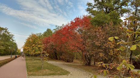
Photo
Where is located Park Tężniowy
Park Tężniowy — local attraction, which is located at Park, Tężniowa, 87-720 Ciechocinek, Poland and belongs to the category — state park. Average visitor rating for this place — 4.5 (according to 574 ratings, information from open sources and relevant for 2022).
Exact location — Park Tężniowy, marked on the map with a red marker.
You can get directions to Park Tężniowy on the map from your location.
What else is interesting in Ciechocinek? You can see all the sights if you go to the city page.
Coordinates
Park Tężniowy, Poland coordinates in decimal format: latitude — 52.884645446089145, longitude — 18.785172032032364. When converted to degrees, minutes, seconds Park Tężniowy has the following coordinates: 52°53′4.72 north latitude and 18°47′6.62 east longitude.
Nearby cities
The largest cities that are located nearby:
- Torun — 20 km
- Wloclawek — 31 km
- Bydgoszcz — 59 km
- Plock — 71 km
- Łódź — 132 km
- Kalisz — 132 km
- Poznań — 137 km
- Elblag — 147 km
- Olsztyn — 148 km
- Gdańsk — 163 km
- Gdynia — 182 km
- Koszalin — 223 km
- Częstochowa — 230 km
- Radom — 230 km
- Wrocław — 231 km
- Kaliningrad
 (Russia) — 231 km
 - Gorzów Wielkopolski — 239 km
- Zielona Gora — 247 km
- Opole — 251 km
Distance to the capital
Distance to the capital (Warsaw) is about — 167 km.