
 Puerto de la Duquesa
La Serna de Iguña
Pumalverde
Puentenansa
La Iglesia
Casar de Periedo
Fuengirola
Renedo de Piélagos
Villabanez
Puerto de la Duquesa
La Serna de Iguña
Pumalverde
Puentenansa
La Iglesia
Casar de Periedo
Fuengirola
Renedo de Piélagos
Villabanez
Consorcio Extremeño Ethnographic Museum "González Santana" on the map, Olivenza, Spain
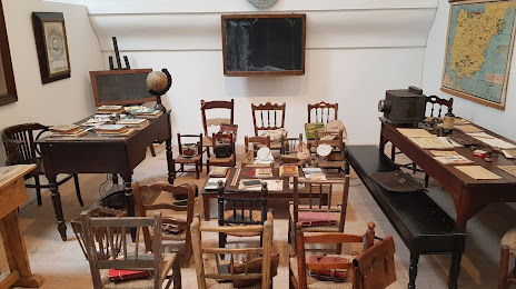
Photo
Where is located Consorcio Extremeño Ethnographic Museum "González Santana"
Consorcio Extremeño Ethnographic Museum "González Santana" — local attraction, which is located at Pl. Sta. María, S/N, 06100 Olivenza, Badajoz, Spain and belongs to the category — ethnographic museum. Average visitor rating for this place — 4.6 (according to 275 ratings, information from open sources and relevant for 2022).
Exact location — Consorcio Extremeño Ethnographic Museum "González Santana", marked on the map with a red marker.
You can get directions to Consorcio Extremeño Ethnographic Museum "González Santana" on the map from your location.
What else is interesting in Olivenza? You can see all the sights if you go to the city page.
Coordinates
Consorcio Extremeño Ethnographic Museum "González Santana", Spain coordinates in decimal format: latitude — 38.68523839284406, longitude — -7.0991366751064575. When converted to degrees, minutes, seconds Consorcio Extremeño Ethnographic Museum "González Santana" has the following coordinates: 38°41′6.86 north latitude and -7°5′56.89 east longitude.
Nearby cities
The largest cities that are located nearby:
- Badajoz — 25 km
- Huelva — 158 km
- Lisbon
 (Portugal) — 176 km
 - Amadora (Portugal) — 183 km
- Dos Hermanas — 186 km
- Queluz (Portugal) — 186 km
- Coimbra (Portugal) — 201 km
- Córdoba — 221 km
- Jerez — 237 km
- Cádiz — 249 km
- Salamanca — 280 km
- Porto (Portugal) — 302 km
- Jaén — 307 km
- Marbella — 311 km
- Algeciras — 317 km
- Málaga — 321 km
- Móstoles — 328 km
- Fuenlabrada — 330 km
- Alcorcón — 332 km
Distance to the capital
Distance to the capital (Madrid) is about — 349 km.