
 Estrella
Bormujos
Bullas
Torremolinos
Totana
Sotelo
Alhama de Aragón
Polinyà
Montmeló
Bárcena de Pie de Concha
Parla
El Campello
La Matanza de Acentejo
Camponaraya
Sant Jordi
Mejorada del Campo
Alarcón
Maro
Montoro
Estrella
Bormujos
Bullas
Torremolinos
Totana
Sotelo
Alhama de Aragón
Polinyà
Montmeló
Bárcena de Pie de Concha
Parla
El Campello
La Matanza de Acentejo
Camponaraya
Sant Jordi
Mejorada del Campo
Alarcón
Maro
Montoro
Olivenza on the map, Spain
Where is located Olivenza
Exact location — Olivenza, Badajoz, Extremadura, Spain, marked on the map with a red marker.
Coordinates
Olivenza, Spain coordinates in decimal format: latitude — 38.6826443, longitude — -7.1026661. When converted to degrees, minutes, seconds Olivenza has the following coordinates: 38°40′57.52 north latitude and -7°6′9.6 east longitude.
Population
Olivenza, Badajoz, Extremadura, Spain, according to our data the population is — 10,788 residents, which is about 0% of the total population of the country (Spain).
Comparison of the population on the graph:
Exact time
Time zone for this location Olivenza — UTC +2 Europe/Madrid. Exact time — monday, 5 may 2024 year, 16 h. 08 minutes.
Sunrise and sunset
Olivenza, sunrise and sunset data for a date — monday 13.05.2024.
| Sunrise | Sunset | Day (duration) |
|---|---|---|
| 07:20 -1 minute | 21:28 +1 minute | 14 h. 6 minutes. +2 minutes |
You can control the scale of the map using the auxiliary tools to find out exactly where it is located Olivenza. When you change the scale of the map, the width of the ruler also changes (in kilometers and miles).
Nearby cities
The largest cities that are located nearby:
- Badajoz — 25 km
- Huelva — 158 km
- Lisbon
 (Portugal) — 176 km
 - Amadora (Portugal) — 183 km
- Dos Hermanas — 186 km
- Queluz (Portugal) — 186 km
- Coimbra (Portugal) — 201 km
- Córdoba — 221 km
- Jerez — 237 km
- Cádiz — 249 km
- Salamanca — 280 km
- Porto (Portugal) — 302 km
- Jaén — 307 km
- Marbella — 311 km
- Algeciras — 317 km
- Málaga — 321 km
- Móstoles — 328 km
- Fuenlabrada — 330 km
- Alcorcón — 332 km
Distance to neighboring capitals:
- Lisbon (Portugal) — 177 km
- Rabat
 (Morocco) — 524 km
 - Andorra la Vella
 (Andorra) — 843 km
 - Paris
 (France) — 1360 km
 - Paris (France) — 1360 km
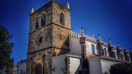
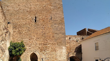
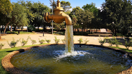
Attractions


Distance to the capital
Distance to the capital (Madrid) is about — 349 km.