
 Puerto de la Duquesa
La Serna de Iguña
Pumalverde
Puentenansa
La Iglesia
Casar de Periedo
Fuengirola
Renedo de Piélagos
Villabanez
Puerto de la Duquesa
La Serna de Iguña
Pumalverde
Puentenansa
La Iglesia
Casar de Periedo
Fuengirola
Renedo de Piélagos
Villabanez
Calle San Miguel on the map, Torremolinos, Spain
Photo
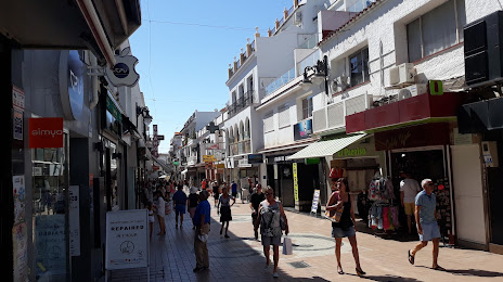
Where is located Calle San Miguel
Calle San Miguel — local attraction, which is located at Málaga and belongs to the category — -. Average visitor rating for this place — - (according to 0 ratings, information from open sources and relevant for 2022).
Exact location — Calle San Miguel, marked on the map with a red marker.
You can get directions to Calle San Miguel on the map from your location.
What else is interesting in Torremolinos? You can see all the sights if you go to the city page.
Coordinates
Calle San Miguel, Spain coordinates in decimal format: latitude — 36.623239531837896, longitude — -4.4985622751656695. When converted to degrees, minutes, seconds Calle San Miguel has the following coordinates: 36°37′23.66 north latitude and -4°29′54.82 east longitude.
Nearby cities
The largest cities that are located nearby:
- Málaga — 6 km
- Marbella — 36 km
- Granada — 100 km
- Algeciras — 101 km
- Tetouan
 (Morocco) — 140 km
 - Córdoba — 142 km
- Jaén — 142 km
- Jerez — 144 km
- Dos Hermanas — 145 km
- Tangier (Morocco) — 153 km
- Cádiz — 159 km
- Almería — 182 km
- Nador (Morocco) — 214 km
- Huelva — 226 km
- Taounate (Morocco) — 231 km
- Taza (Morocco) — 270 km
- Meknes (Morocco) — 317 km
- Oujda (Morocco) — 318 km
- Kenitra (Morocco) — 324 km
Distance to the capital
Distance to the capital (Madrid) is about — 428 km.