
 Puerto de la Duquesa
La Serna de Iguña
Pumalverde
Puentenansa
La Iglesia
Casar de Periedo
Fuengirola
Renedo de Piélagos
Villabanez
Puerto de la Duquesa
La Serna de Iguña
Pumalverde
Puentenansa
La Iglesia
Casar de Periedo
Fuengirola
Renedo de Piélagos
Villabanez
Vallgrassa.Centre Experimental de les Arts on the map, Castelldefels, Spain
Photo
Where is located Vallgrassa.Centre Experimental de les Arts
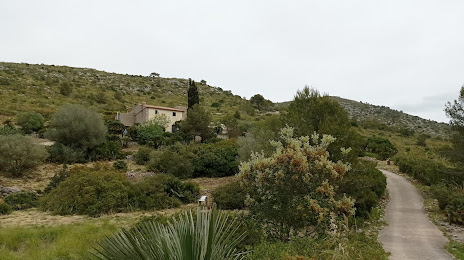
Vallgrassa.Centre Experimental de les Arts — local attraction, which is located at 08859 Begues, Barcelona, Spain and belongs to the category — open air museum. Average visitor rating for this place — 4.6 (according to 18 ratings, information from open sources and relevant for 2022).
Exact location — Vallgrassa.Centre Experimental de les Arts, marked on the map with a red marker.
You can get directions to Vallgrassa.Centre Experimental de les Arts on the map from your location.
What else is interesting in Castelldefels? You can see all the sights if you go to the city page.
Coordinates
Vallgrassa.Centre Experimental de les Arts, Spain coordinates in decimal format: latitude — 41.28630840081713, longitude — 1.8774462249720605. When converted to degrees, minutes, seconds Vallgrassa.Centre Experimental de les Arts has the following coordinates: 41°17′10.71 north latitude and 1°52′38.81 east longitude.
Nearby cities
The largest cities that are located nearby:
- L'Hospitalet de Llobregat — 15 km
- Santa Coloma de Gramenet — 27 km
- Badalona — 29 km
- Sabadell — 31 km
- Terrassa — 31 km
- Mataró — 48 km
- Tarragona — 64 km
- Lleida — 118 km
- Perpignan
 (France) — 173 km
 - Palma — 198 km
- Zaragoza — 240 km
- Toulouse (France) — 261 km
- Valencia — 284 km
- Montpellier (France) — 299 km
- Pamplona — 339 km
- Nimes (France) — 341 km
- Marseille (France) — 353 km
- Aix-en-Provence (France) — 373 km
- Toulon (France) — 378 km
Distance to the capital
Distance to the capital (Madrid) is about — 479 km.