
 Puerto de la Duquesa
La Serna de Iguña
Pumalverde
Puentenansa
La Iglesia
Casar de Periedo
Fuengirola
Renedo de Piélagos
Villabanez
Puerto de la Duquesa
La Serna de Iguña
Pumalverde
Puentenansa
La Iglesia
Casar de Periedo
Fuengirola
Renedo de Piélagos
Villabanez
Valle del Aragón on the map, Jaca, Spain
Photo
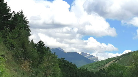
Where is located Valle del Aragón
Valle del Aragón — local attraction, which is located at Huesca and belongs to the category — -. Average visitor rating for this place — 4.5 (according to 2 ratings, information from open sources and relevant for 2022).
Exact location — Valle del Aragón, marked on the map with a red marker.
You can get directions to Valle del Aragón on the map from your location.
What else is interesting in Jaca? You can see all the sights if you go to the city page.
Coordinates
Valle del Aragón, Spain coordinates in decimal format: latitude — 42.57233098276414, longitude — -0.5486087107378385. When converted to degrees, minutes, seconds Valle del Aragón has the following coordinates: 42°34′20.39 north latitude and -0°32′54.99 east longitude.
Nearby cities
The largest cities that are located nearby:
- Pamplona — 93 km
- Zaragoza — 106 km
- San Sebastián — 142 km
- Lleida — 143 km
- Logroño — 155 km
- Vitoria-Gasteiz — 176 km
- Toulouse
 (France) — 196 km
 - Bilbao — 207 km
- Tarragona — 219 km
- Terrassa — 239 km
- Sabadell — 247 km
- Bordeaux (France) — 251 km
- L'Hospitalet de Llobregat — 258 km
- Burgos — 259 km
- Santa Coloma de Gramenet — 260 km
- Badalona — 263 km
- Mataró — 273 km
- Santander — 280 km
- Perpignan (France) — 280 km
Distance to the capital
Distance to the capital (Madrid) is about — 356 km.