São Joaquim do Monte
Camutanga
Pescador
Braço do Trombudo
Pocinhos
Florestal
Iraí de Minas
Sumidouro
São João do Sul
Santa Maria de Itabira
Prados
Jundiá
Alto Araguaia
Brejo
Girau do Ponciano
Fortaleza dos Nogueiras
Ibiraiaras
Virmond
Ibiá
São Joaquim do Monte
Camutanga
Pescador
Braço do Trombudo
Pocinhos
Florestal
Iraí de Minas
Sumidouro
São João do Sul
Santa Maria de Itabira
Prados
Jundiá
Alto Araguaia
Brejo
Girau do Ponciano
Fortaleza dos Nogueiras
Ibiraiaras
Virmond
Ibiá
Salvaterra on the map, Brazil
Where is located Salvaterra
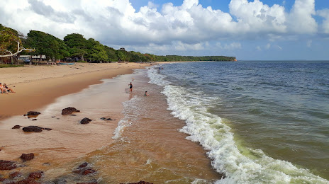
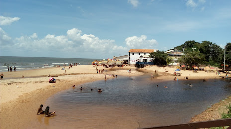
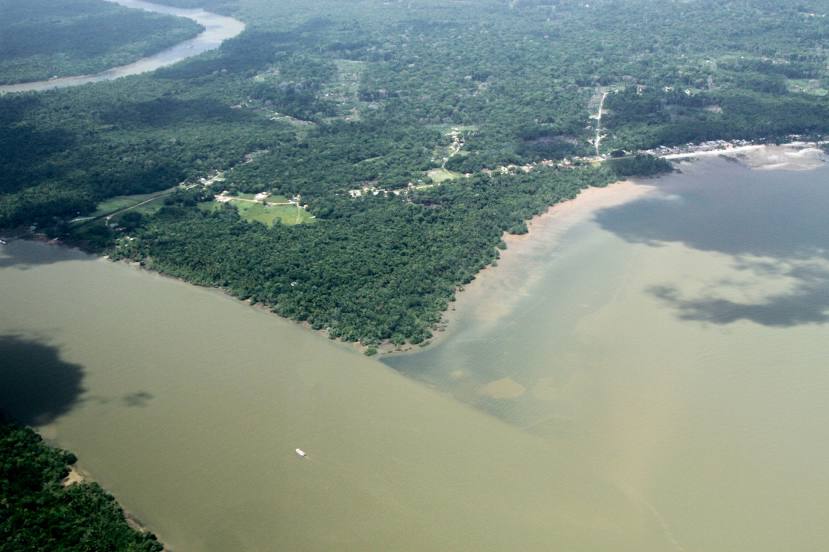
Exact location — Salvaterra, Salvaterra, Pará, Brazil, marked on the map with a red marker.
Coordinates
Salvaterra, Brazil coordinates in decimal format: latitude — -0.7587978, longitude — -48.514345. When converted to degrees, minutes, seconds Salvaterra has the following coordinates: -0°45′31.67 north latitude and -48°30′51.64 east longitude.
Population
Salvaterra, Salvaterra, Pará, Brazil, according to our data the population is — 13,615 residents, which is about 0% of the total population of the country (Brazil).
Comparison of the population on the graph:
Exact time
Time zone for this location Salvaterra — UTC -3 America/Belem. Exact time — saturday, 4 april 2024 year, 16 h. 10 minutes.
Sunrise and sunset
Salvaterra, sunrise and sunset data for a date — saturday 27.04.2024.
| Sunrise | Sunset | Day (duration) |
|---|---|---|
| 06:11 -0 minutes | 18:11 -1 minute | 12 h. 0 minutes. -1 minute |
You can control the scale of the map using the auxiliary tools to find out exactly where it is located Salvaterra. When you change the scale of the map, the width of the ruler also changes (in kilometers and miles).
Nearby cities
The largest cities that are located nearby:
- Ananindeua — 69 km
- Belém — 77 km
- Castanhal — 89 km
- Macapá — 296 km
- São Luís — 507 km
- Marabá — 516 km
- Imperatriz — 539 km
- Santarém — 709 km
- Araguaína — 712 km
- Caxias — 727 km
- Parnaíba — 781 km
- Timon — 788 km
- Teresina — 791 km
- Paramaribo
 (Suriname) — 1037 km
 - Palmas — 1049 km
- Caucaia — 1135 km
- Maracanaú — 1144 km
- Fortaleza — 1150 km
- Juazeiro do Norte — 1237 km
Distance to neighboring capitals:
- Paramaribo (Suriname) — 1045 km
- Georgetown
 (Guyana) — 1362 km
 - Caracas
 (Venezuela) — 2393 km
 - Nuestra Señora de La Paz
 (Bolivia) — 2774 km
 - Asuncion
 (Paraguay) — 2894 km
 - Asuncion (Paraguay) — 2898 km
- Bogota
 (Colombia) — 2902 km
 - Quito
 (Ecuador) — 3332 km
 - Montevideo
 (Uruguay) — 3880 km
 - Buenos Aires
 (Argentina) — 3902 km
 - Santiago
 (Chile) — 4307 km