
 Maureville
Samoëns
Gréning
Toulouse
Volx
Goudet
Méhoncourt
Saint-Hymer
Pontcarré
Maureville
Samoëns
Gréning
Toulouse
Volx
Goudet
Méhoncourt
Saint-Hymer
Pontcarré
Indian Forest Figuerolles on the map, Martigues, France
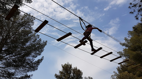
Photo
Where is located Indian Forest Figuerolles
Indian Forest Figuerolles — local attraction, which is located at Chem. de Figuerolles, 13500 Martigues, France and belongs to the category — park. Average visitor rating for this place — 4.4 (according to 236 ratings, information from open sources and relevant for 2022).
Exact location — Indian Forest Figuerolles, marked on the map with a red marker.
You can get directions to Indian Forest Figuerolles on the map from your location.
What else is interesting in Martigues? You can see all the sights if you go to the city page.
Coordinates
Indian Forest Figuerolles, France coordinates in decimal format: latitude — 43.43557242088984, longitude — 5.043067125040133. When converted to degrees, minutes, seconds Indian Forest Figuerolles has the following coordinates: 43°26′8.06 north latitude and 5°2′35.04 east longitude.
Nearby cities
The largest cities that are located nearby:
- Marseille — 28 km
- Aix-en-Provence — 34 km
- Nimes — 73 km
- Toulon — 77 km
- Montpellier — 97 km
- Nice — 180 km
- Perpignan — 192 km
- Grenoble — 204 km
- Saint-Étienne — 231 km
- Lyon — 261 km
- Villeurbanne — 262 km
- Turin
 (Italy) — 276 km
 - Toulouse — 290 km
- Mataró
 (Spain) — 299 km
 - Clermont-Ferrand — 303 km
- Badalona (Spain) — 318 km
- Sabadell (Spain) — 319 km
- Geneva
 (Switzerland) — 320 km
 - Santa Coloma de Gramenet (Spain) — 320 km
Distance to the capital
Distance to the capital (Paris) is about — 638 km.