
 Maureville
Samoëns
Gréning
Toulouse
Volx
Goudet
Méhoncourt
Saint-Hymer
Pontcarré
Maureville
Samoëns
Gréning
Toulouse
Volx
Goudet
Méhoncourt
Saint-Hymer
Pontcarré
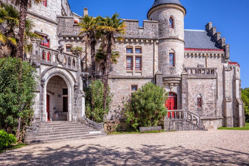
Château d'Abbadie on the map, Hendaye, France
Photo
Where is located Château d'Abbadie
Château d'Abbadie — local attraction, which is located at Rte de la Corniche, 64700 Hendaye, France and belongs to the category — archive. Average visitor rating for this place — 4.4 (according to 3274 ratings, information from open sources and relevant for 2022).
Exact location — Château d'Abbadie, marked on the map with a red marker.
You can get directions to Château d'Abbadie on the map from your location.
What else is interesting in Hendaye? You can see all the sights if you go to the city page.
Coordinates
Château d'Abbadie, France coordinates in decimal format: latitude — 43.377413287215965, longitude — -1.7493740749617401. When converted to degrees, minutes, seconds Château d'Abbadie has the following coordinates: 43°22′38.69 north latitude and -1°44′57.75 east longitude.
Nearby cities
The largest cities that are located nearby:
- San Sebastián
 (Spain) — 18 km
 - Pamplona (Spain) — 61 km
- Vitoria-Gasteiz (Spain) — 93 km
- Bilbao (Spain) — 95 km
- Logroño (Spain) — 114 km
- Santander (Spain) — 164 km
- Bordeaux — 188 km
- Burgos (Spain) — 194 km
- Zaragoza (Spain) — 203 km
- Toulouse — 258 km
- Lleida (Spain) — 276 km
- Valladolid (Spain) — 309 km
- Gijón (Spain) — 313 km
- León (Spain) — 321 km
- Oviedo (Spain) — 328 km
- Alcala de Henares (Spain) — 345 km
- Alcobendas (Spain) — 349 km
- Torrejón de Ardoz (Spain) — 352 km
- Tarragona (Spain) — 352 km
Distance to the capital
Distance to the capital (Paris) is about — 686 km.