
 Maureville
Samoëns
Gréning
Toulouse
Volx
Goudet
Méhoncourt
Saint-Hymer
Pontcarré
Maureville
Samoëns
Gréning
Toulouse
Volx
Goudet
Méhoncourt
Saint-Hymer
Pontcarré
Parachute City and Light Aviation - Memorial Museum on the map, Pau, France
Photo
Where is located Parachute City and Light Aviation - Memorial Museum
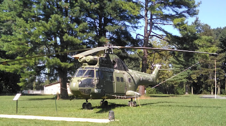
Parachute City and Light Aviation - Memorial Museum — local attraction, which is located at Chem. d'Astra, 64140 Lons, France and belongs to the category — museum. Average visitor rating for this place — 4.7 (according to 319 ratings, information from open sources and relevant for 2022).
Exact location — Parachute City and Light Aviation - Memorial Museum, marked on the map with a red marker.
You can get directions to Parachute City and Light Aviation - Memorial Museum on the map from your location.
What else is interesting in Pau? You can see all the sights if you go to the city page.
Coordinates
Parachute City and Light Aviation - Memorial Museum, France coordinates in decimal format: latitude — 43.34624466918419, longitude — -0.3870873749627507. When converted to degrees, minutes, seconds Parachute City and Light Aviation - Memorial Museum has the following coordinates: 43°20′46.48 north latitude and -0°23′13.51 east longitude.
Nearby cities
The largest cities that are located nearby:
- Pamplona
 (Spain) — 116 km
 - San Sebastián (Spain) — 130 km
- Toulouse — 149 km
- Bordeaux — 171 km
- Zaragoza (Spain) — 187 km
- Logroño (Spain) — 193 km
- Vitoria-Gasteiz (Spain) — 193 km
- Lleida (Spain) — 203 km
- Bilbao (Spain) — 206 km
- Perpignan — 274 km
- Terrassa (Spain) — 275 km
- Tarragona (Spain) — 276 km
- Santander (Spain) — 277 km
- Sabadell (Spain) — 282 km
- Burgos (Spain) — 291 km
- Santa Coloma de Gramenet (Spain) — 296 km
- L'Hospitalet de Llobregat (Spain) — 297 km
- Badalona (Spain) — 298 km
- Mataró (Spain) — 303 km
Distance to the capital
Distance to the capital (Paris) is about — 648 km.