
 Maureville
Samoëns
Gréning
Toulouse
Volx
Goudet
Méhoncourt
Saint-Hymer
Pontcarré
Maureville
Samoëns
Gréning
Toulouse
Volx
Goudet
Méhoncourt
Saint-Hymer
Pontcarré
Musée des Boissons on the map, Les Ponts-de-Cé, France
Photo
Where is located Musée des Boissons
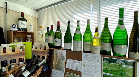
Musée des Boissons — local attraction, which is located at 46 Rte des Ponts de Ce, 49130 Sainte-Gemmes-sur-Loire, France and belongs to the category — museum. Average visitor rating for this place — 4.5 (according to 23 ratings, information from open sources and relevant for 2022).
Exact location — Musée des Boissons, marked on the map with a red marker.
You can get directions to Musée des Boissons on the map from your location.
What else is interesting in Les Ponts-de-Cé? You can see all the sights if you go to the city page.
Coordinates
Musée des Boissons, France coordinates in decimal format: latitude — 47.42708811657851, longitude — -0.5504150748262688. When converted to degrees, minutes, seconds Musée des Boissons has the following coordinates: 47°25′37.52 north latitude and -0°33′1.49 east longitude.
Nearby cities
The largest cities that are located nearby:
- Angers — 7 km
- Nantes — 81 km
- Le Mans — 84 km
- Tours — 91 km
- Rennes — 114 km
- Orléans — 188 km
- Caen — 195 km
- Limoges — 223 km
- Le Havre — 233 km
- Rouen — 252 km
- Boulogne-Billancourt — 255 km
- Bordeaux — 286 km
- Brest — 310 km
- Clermont-Ferrand — 333 km
- Amiens — 339 km
- Eastbourne
 (United Kingdom) — 374 km
 - Bournemouth (United Kingdom) — 376 km
- Portsmouth (United Kingdom) — 377 km
- Reims — 386 km
Distance to the capital
Distance to the capital (Paris) is about — 268 km.