
 Maureville
Samoëns
Gréning
Toulouse
Volx
Goudet
Méhoncourt
Saint-Hymer
Pontcarré
Maureville
Samoëns
Gréning
Toulouse
Volx
Goudet
Méhoncourt
Saint-Hymer
Pontcarré
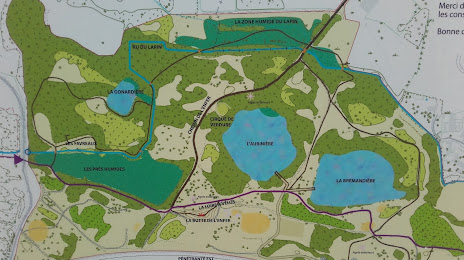
Park Ardoisières on the map, Les Ponts-de-Cé, France
Photo
Where is located Park Ardoisières
Park Ardoisières — local attraction, which is located at 94 Rue Edouard Vaillant, 49800 Trélazé, France and belongs to the category — park. Average visitor rating for this place — 4.3 (according to 830 ratings, information from open sources and relevant for 2022).
Exact location — Park Ardoisières, marked on the map with a red marker.
You can get directions to Park Ardoisières on the map from your location.
What else is interesting in Les Ponts-de-Cé? You can see all the sights if you go to the city page.
Coordinates
Park Ardoisières, France coordinates in decimal format: latitude — 47.45068092510732, longitude — -0.486273071110733. When converted to degrees, minutes, seconds Park Ardoisières has the following coordinates: 47°27′2.45 north latitude and -0°29′10.58 east longitude.
Nearby cities
The largest cities that are located nearby:
- Angers — 7 km
- Nantes — 81 km
- Le Mans — 84 km
- Tours — 91 km
- Rennes — 114 km
- Orléans — 188 km
- Caen — 195 km
- Limoges — 223 km
- Le Havre — 233 km
- Rouen — 252 km
- Boulogne-Billancourt — 255 km
- Bordeaux — 286 km
- Brest — 310 km
- Clermont-Ferrand — 333 km
- Amiens — 339 km
- Eastbourne
 (United Kingdom) — 374 km
 - Bournemouth (United Kingdom) — 376 km
- Portsmouth (United Kingdom) — 377 km
- Reims — 386 km
Distance to the capital
Distance to the capital (Paris) is about — 262 km.