
 Maureville
Samoëns
Gréning
Toulouse
Volx
Goudet
Méhoncourt
Saint-Hymer
Pontcarré
Maureville
Samoëns
Gréning
Toulouse
Volx
Goudet
Méhoncourt
Saint-Hymer
Pontcarré
Ile de Loisirs de Cergy-Pontoise on the map, Conflans-Sainte-Honorine, France
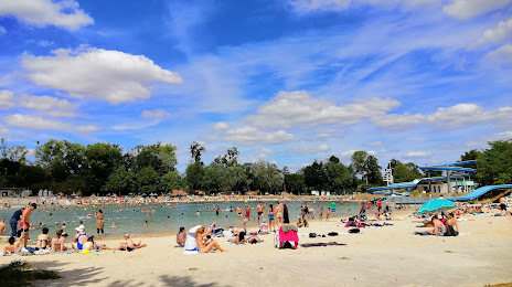
Photo
Where is located Ile de Loisirs de Cergy-Pontoise
Ile de Loisirs de Cergy-Pontoise — local attraction, which is located at 1 Rue des Étangs, 95000 Neuville-sur-Oise, France and belongs to the category — amusement center. Average visitor rating for this place — 4.2 (according to 5671 rating, information from open sources and relevant for 2022).
Exact location — Ile de Loisirs de Cergy-Pontoise, marked on the map with a red marker.
You can get directions to Ile de Loisirs de Cergy-Pontoise on the map from your location.
What else is interesting in Conflans-Sainte-Honorine? You can see all the sights if you go to the city page.
Coordinates
Ile de Loisirs de Cergy-Pontoise, France coordinates in decimal format: latitude — 49.030456424314615, longitude — 2.0485211252299105. When converted to degrees, minutes, seconds Ile de Loisirs de Cergy-Pontoise has the following coordinates: 49°1′49.64 north latitude and 2°2′54.68 east longitude.
Nearby cities
The largest cities that are located nearby:
- Boulogne-Billancourt — 21 km
- Rouen — 86 km
- Amiens — 100 km
- Orléans — 122 km
- Reims — 143 km
- Le Havre — 153 km
- Le Mans — 178 km
- Caen — 179 km
- Lille — 192 km
- Tours — 206 km
- Charleroi
 (Belgium) — 228 km
 - Eastbourne
 (United Kingdom) — 233 km
 - Namur (Belgium) — 254 km
- Brussels (Belgium) — 258 km
- Angers — 260 km
- Crawley (United Kingdom) — 282 km
- Gillingham (United Kingdom) — 284 km
- Dijon — 289 km
- Antwerp (Belgium) — 293 km
Distance to the capital
Distance to the capital (Paris) is about — 29 km.