
 Maureville
Samoëns
Gréning
Toulouse
Volx
Goudet
Méhoncourt
Saint-Hymer
Pontcarré
Maureville
Samoëns
Gréning
Toulouse
Volx
Goudet
Méhoncourt
Saint-Hymer
Pontcarré
Étang de Saint-Quentin on the map, Saint-Cyr-l'École, France
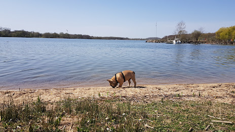
Photo
Where is located Étang de Saint-Quentin
Étang de Saint-Quentin — local attraction, which is located at 250 ha and belongs to the category — -. Average visitor rating for this place — 4.4 (according to 70 ratings, information from open sources and relevant for 2022).
Exact location — Étang de Saint-Quentin, marked on the map with a red marker.
You can get directions to Étang de Saint-Quentin on the map from your location.
What else is interesting in Saint-Cyr-l'École? You can see all the sights if you go to the city page.
Coordinates
Étang de Saint-Quentin, France coordinates in decimal format: latitude — 48.78669009612378, longitude — 2.0149448527038527. When converted to degrees, minutes, seconds Étang de Saint-Quentin has the following coordinates: 48°47′12.08 north latitude and 2°0′53.8 east longitude.
Nearby cities
The largest cities that are located nearby:
- Boulogne-Billancourt — 13 km
- Rouen — 99 km
- Orléans — 101 km
- Amiens — 121 km
- Reims — 150 km
- Le Havre — 160 km
- Le Mans — 164 km
- Caen — 181 km
- Tours — 187 km
- Lille — 213 km
- Charleroi
 (Belgium) — 244 km
 - Angers — 245 km
- Eastbourne
 (United Kingdom) — 250 km
 - Namur (Belgium) — 270 km
- Brussels (Belgium) — 277 km
- Dijon — 277 km
- Rennes — 287 km
- Crawley (United Kingdom) — 299 km
- Metz — 299 km
Distance to the capital
Distance to the capital (Paris) is about — 26 km.