
 Maureville
Samoëns
Gréning
Toulouse
Volx
Goudet
Méhoncourt
Saint-Hymer
Pontcarré
Maureville
Samoëns
Gréning
Toulouse
Volx
Goudet
Méhoncourt
Saint-Hymer
Pontcarré
Fernet Branca Foundation on the map, Saint-Louis, France
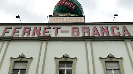
Photo
Where is located Fernet Branca Foundation
Fernet Branca Foundation — local attraction, which is located at 2 Rue du Ballon, 68300 Saint-Louis, France and belongs to the category — museum. Average visitor rating for this place — 4.3 (according to 123 ratings, information from open sources and relevant for 2022).
Exact location — Fernet Branca Foundation, marked on the map with a red marker.
You can get directions to Fernet Branca Foundation on the map from your location.
What else is interesting in Saint-Louis? You can see all the sights if you go to the city page.
Coordinates
Fernet Branca Foundation, France coordinates in decimal format: latitude — 47.58496651468152, longitude — 7.560148725179187. When converted to degrees, minutes, seconds Fernet Branca Foundation has the following coordinates: 47°35′5.88 north latitude and 7°33′36.54 east longitude.
Nearby cities
The largest cities that are located nearby:
- Basel
 (Switzerland) — 3 km
 - Mulhouse — 25 km
- Freiburg
 (Germany) — 50 km
 - Bern (Switzerland) — 71 km
- Zurich (Switzerland) — 77 km
- Strasbourg — 110 km
- Besançon — 122 km
- Lausanne (Switzerland) — 137 km
- Reutlingen (Germany) — 157 km
- Nancy — 158 km
- Pforzheim (Germany) — 166 km
- Karlsruhe (Germany) — 168 km
- Stuttgart (Germany) — 177 km
- Saarbrücken (Germany) — 187 km
- Geneva (Switzerland) — 188 km
- Dijon — 191 km
- Metz — 197 km
- Ulm (Germany) — 199 km
- Heilbronn (Germany) — 209 km
Distance to the capital
Distance to the capital (Paris) is about — 411 km.