
 Norra Grean
Asslebyn
Gillanda
Ödebyn
Håltane
Torp
Tjärtakan
Flicksäter
Dykälla
Norra Grean
Asslebyn
Gillanda
Ödebyn
Håltane
Torp
Tjärtakan
Flicksäter
Dykälla
Örebro Castle on the map, Orebro, Sweden
Photo
Where is located Örebro Castle
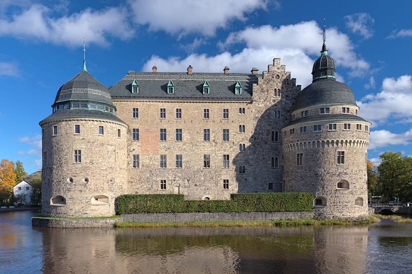
Örebro Castle — local attraction, which is located at Kansligatan 1, 703 61 Örebro, Sweden and belongs to the category — castle. Average visitor rating for this place — 4.3 (according to 4858 ratings, information from open sources and relevant for 2022).
Exact location — Örebro Castle, marked on the map with a red marker.
You can get directions to Örebro Castle on the map from your location.
What else is interesting in Orebro? You can see all the sights if you go to the city page.
Coordinates
Örebro Castle, Sweden coordinates in decimal format: latitude — 59.2739469138841, longitude — 15.215186925619422. When converted to degrees, minutes, seconds Örebro Castle has the following coordinates: 59°16′26.21 north latitude and 15°12′54.67 east longitude.
Nearby cities
The largest cities that are located nearby:
- Västerås — 83 km
- Uppsala — 149 km
- Stockholm — 161 km
- Oslo
 (Norway) — 257 km
 - Aalborg
 (Denmark) — 402 km
 - Turku
 (Finland) — 406 km
 - Malmö — 429 km
- Copenhagen (Denmark) — 431 km
- Aarhus (Denmark) — 462 km
- Tampere (Finland) — 514 km
- Trondheim (Norway) — 518 km
- Odense (Denmark) — 524 km
- Espoo (Finland) — 529 km
- Tallinn
 (Estonia) — 537 km
 - Klaipėda
 (Lithuania) — 541 km
 - Stavanger (Norway) — 541 km
- Helsinki (Finland) — 544 km
- Vantaa (Finland) — 550 km
- Bergen (Norway) — 554 km
Distance to the capital
Distance to the capital (Stockholm) is about — 156 km.