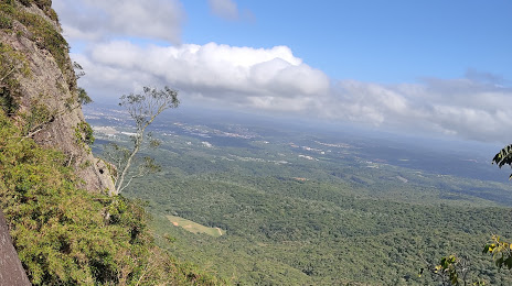
Jaquirana — Mariópolis
Jaquirana — São Cristóvão
Jaquirana — Department
Jaquirana — General Salgado
Jaquirana — Resende Costa
Jaquirana — Paranaguá
Jaquirana — Gália
Jaquirana — Meleiro
Jaquirana — Uberaba
Jaquirana — Lapa
Jaquirana — Santa Cruz
Jaquirana — Buritirana
Jaquirana — Itanhomi
Jaquirana — Marco
Jaquirana — Progresso
Jaquirana — Estrela D'Oeste
Jaquirana — Manaus
Jaquirana — Dourados
Jaquirana — Montezuma
Capão Alto
Lages
Lages
Correia Pinto
Santa Cecília
Residência Fuck
Monte Castelo
Papanduva
Mafra
Rio Negro
Campo do Tenente
Quitandinha
Mandirituba
Fazenda Rio Grande
São José dos Pinhais
Jaquirana — Piraquara distance, route on the map
Distance by car
Distance between Jaquirana, Rio Grande do Sul, Brazil and Piraquara, Paraná, Brazil by car is — km, or miles. To travel this distance by car, you need minute, or h.
Route on the map, driving directions
Car route Jaquirana — Piraquara was created automatically. The road on the map is shown as a blue line. By moving the markers, you can create a new route through the points you need.
Passing cities through which the car route passes: Vacaria, Capão Alto, Lages, Lages, Correia Pinto, Santa Cecília, Residência Fuck, Monte Castelo, Papanduva, Mafra, Rio Negro, Campo do Tenente, Quitandinha, Mandirituba, Fazenda Rio Grande, São José dos Pinhais.
Distance by plane
If you decide to take a trip Jaquirana Piraquara by plane, then you have to fly the distance — 404 km or 250 miles. It is marked on the map with a gray line (between two points in a straight line).
Flight time
Estimated flight time Jaquirana Piraquara by plane at cruising speed 750 km / h will be — 32 min.
Direction of movement
Brazil, Jaquirana — right-hand traffic. Brazil, Piraquara — right-hand traffic.
Difference in time
Jaquirana and Piraquara are in the same time zone. Between them there is no time difference (UTC -3 America/Sao_Paulo).
Interesting Facts
Information on alternative ways to get to your destination.
The length of this distance is about 1.0% of the total length of the equator.
The percentage of the population is clearly shown in the graph:
Jaquirana — 4,320 (less by 36,842), Piraquara — 41,162 residents.
The cost of travel
Calculate the cost of the trip yourself using the fuel consumption calculator, changing the data in the table.