
 Los Mangos
Guangololo
Las Crucitas
Descombros
Santa Elena
Dixon Cove
El Ocotal
Bijagual
Cayo Sierra
Los Mangos
Guangololo
Las Crucitas
Descombros
Santa Elena
Dixon Cove
El Ocotal
Bijagual
Cayo Sierra
Santa Barbara Central Park on the map, Santa Barbara, Honduras
Photo
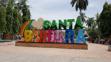
Where is located Santa Barbara Central Park
Santa Barbara Central Park — local attraction, which is located at WQ97+9P8, Santa Barbara, Honduras and belongs to the category — national park. Average visitor rating for this place — 4.4 (according to 1428 ratings, information from open sources and relevant for 2022).
Exact location — Santa Barbara Central Park, marked on the map with a red marker.
You can get directions to Santa Barbara Central Park on the map from your location.
What else is interesting in Santa Barbara? You can see all the sights if you go to the city page.
Coordinates
Santa Barbara Central Park, Honduras coordinates in decimal format: latitude — 14.918363253578809, longitude — -88.2357210757011. When converted to degrees, minutes, seconds Santa Barbara Central Park has the following coordinates: 14°55′6.11 north latitude and -88°14′8.6 east longitude.
Nearby cities
The largest cities that are located nearby:
- San Pedro Sula — 68 km
- El Progreso — 70 km
- Choloma — 81 km
- Apopa
 (El Salvador) — 159 km
 - San Miguel (El Salvador) — 160 km
- Soyapango (El Salvador) — 165 km
- Mejicanos (El Salvador) — 168 km
- San Salvador (El Salvador) — 172 km
- La Ceiba — 176 km
- Santa Ana (El Salvador) — 176 km
- Santa Tecla (El Salvador) — 178 km
- Guatemala City
 (Guatemala) — 248 km
 - Villa Canales (Guatemala) — 248 km
- Villa Nueva (Guatemala) — 255 km
- San Juan Sacatepéquez (Guatemala) — 258 km
- Chinandega
 (Nicaragua) — 281 km
 - Escuintla (Guatemala) — 282 km
- Lion (Nicaragua) — 312 km
- Quetzaltenango (Guatemala) — 351 km
Distance to the capital
Distance to the capital (Tegucigalpa) is about — 144 km.