Campo Bonito — Ladário
Campo Bonito — Piratuba
Campo Bonito — Lobato
Campo Bonito — Lagarto
Campo Bonito — Capinópolis
Campo Bonito — Guadalupe
Campo Bonito — Maringa
Campo Bonito — São Miguel dos Milagres
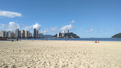
Campo Bonito — São Paulo
Campo Bonito — Saúde
Campo Bonito — Lagoa Vermelha
Campo Bonito — Cumaru
Campo Bonito — Campo Largo
Campo Bonito — Uruguaiana International Airport
Campo Bonito — Palmeira das Missões
Campo Bonito — Gramados
Campo Bonito — Pedregulho
Campo Bonito — Barrinha
Campo Bonito — São Francisco do Sul
Guaraniaçu
Laranjeiras do Sul
Virmond
Guarapuava
Irati
Palmeira
Campo Largo
Campo Magro
Curitiba
Curitiba
Curitiba Airport
Pinhais
Quatro Barras
Campina Grande do Sul
Cajati
Registro
Miracatu
Pedro de Toledo
Peruíbe
Mongaguá
Spa Esmeralda
Campo Bonito — Ladário
Campo Bonito — Piratuba
Campo Bonito — Lobato
Campo Bonito — Lagarto
Campo Bonito — Capinópolis
Campo Bonito — Guadalupe
Campo Bonito — Maringa
Campo Bonito — São Miguel dos Milagres
Campo Bonito — São Paulo
Campo Bonito — Saúde
Campo Bonito — Lagoa Vermelha
Campo Bonito — Cumaru
Campo Bonito — Campo Largo
Campo Bonito — Uruguaiana International Airport
Campo Bonito — Palmeira das Missões
Campo Bonito — Gramados
Campo Bonito — Pedregulho
Campo Bonito — Barrinha
Campo Bonito — São Francisco do Sul
Guaraniaçu
Laranjeiras do Sul
Virmond
Guarapuava
Irati
Palmeira
Campo Largo
Campo Magro
Curitiba
Curitiba
Curitiba Airport
Pinhais
Quatro Barras
Campina Grande do Sul
Cajati
Registro
Miracatu
Pedro de Toledo
Peruíbe
Mongaguá
Spa Esmeralda
Campo Bonito — Praia Grande distance, route on the map
Distance by car
Distance between Campo Bonito, Paraná, Brazil and Praia Grande, São Paulo, Brazil by car is — km, or miles. To travel this distance by car, you need minute, or h.
Route on the map, driving directions
Car route Campo Bonito — Praia Grande was created automatically. The road on the map is shown as a blue line. By moving the markers, you can create a new route through the points you need.
Passing cities through which the car route passes: Guaraniaçu, Guaraniaçu, Laranjeiras do Sul, Virmond, Guarapuava, Irati, Palmeira, Campo Largo, Campo Magro, Curitiba, Curitiba, Curitiba Airport, Pinhais, Quatro Barras, Campina Grande do Sul, Cajati, Registro, Miracatu, Pedro de Toledo, Peruíbe, Mongaguá, Spa Esmeralda.
Distance by plane
If you decide to take a trip Campo Bonito Praia Grande by plane, then you have to fly the distance — 676 km or 419 miles. It is marked on the map with a gray line (between two points in a straight line).
Flight time
Estimated flight time Campo Bonito Praia Grande by plane at cruising speed 750 km / h will be — 54 min.
Direction of movement
Brazil, Campo Bonito — right-hand traffic. Brazil, Praia Grande — right-hand traffic.
Difference in time
Campo Bonito and Praia Grande are in the same time zone. Between them there is no time difference (UTC -3 America/Sao_Paulo).
Interesting Facts
Information on alternative ways to get to your destination.
The length of this distance is about 1.7% of the total length of the equator.
The percentage of the population is clearly shown in the graph:
Campo Bonito — 4,933 (less by 245,099), Praia Grande — 250,032 residents.
The cost of travel
Calculate the cost of the trip yourself using the fuel consumption calculator, changing the data in the table.