 Warner Robins
Wantagh
Bethel
Misty Hill Farm
United States
Wakonda Beach (R33) Airport
Wilmington
Poland
Miami International Airport
Warner Robins
Wantagh
Bethel
Misty Hill Farm
United States
Wakonda Beach (R33) Airport
Wilmington
Poland
Miami International Airport
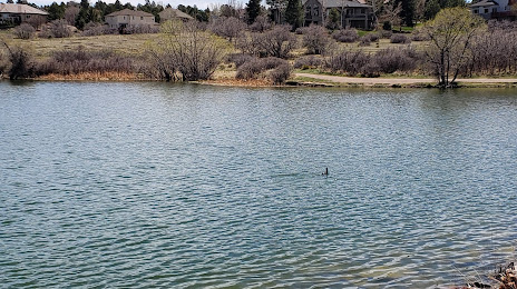
Bingham Lake on the map, The Pinery, United States
Photo
Where is located Bingham Lake
Bingham Lake — local attraction, which is located at no data and belongs to the category — -. Average visitor rating for this place — 4.6 (according to 59 ratings, information from open sources and relevant for 2022).
Exact location — Bingham Lake, marked on the map with a red marker.
You can get directions to Bingham Lake on the map from your location.
What else is interesting in The Pinery? You can see all the sights if you go to the city page.
Coordinates
Bingham Lake, United States coordinates in decimal format: latitude — 39.45103620718921, longitude — -104.74421357517832. When converted to degrees, minutes, seconds Bingham Lake has the following coordinates: 39°27′3.73 north latitude and -104°44′39.17 east longitude.
Nearby cities
The largest cities that are located nearby:
- Aurora — 31 km
- Denver — 38 km
- Lakewood — 40 km
- Arvada — 49 km
- Westminster — 49 km
- Thornton — 50 km
- Colorado Springs — 69 km
- Fort Collins — 128 km
- Pueblo — 133 km
- Albuquerque — 512 km
- Amarillo — 536 km
- Valencia — 545 km
- Provo — 591 km
- Salt Lake City — 617 km
- West Jordan — 618 km
- West Valley City — 624 km
- Wichita — 676 km
- Lincoln — 690 km
- Lubbock — 702 km
Distance to the capital
Distance to the capital (Washington) is about — 2380 km.