
 Litoral Del Bajo San Juan
El Cantón de San Pablo
Juan Frío
Santa Barbara
El Juncal
Dibulla
Vereda Campo Alegre
San Pablo
Guaramito
Litoral Del Bajo San Juan
El Cantón de San Pablo
Juan Frío
Santa Barbara
El Juncal
Dibulla
Vereda Campo Alegre
San Pablo
Guaramito
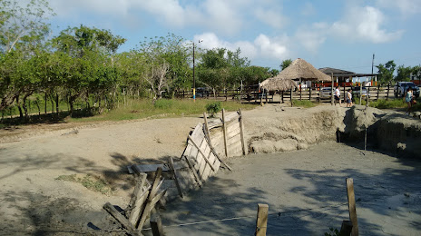
Volcán de Lodo El Tesoro on the map, San Antero, Colombia
Photo
Where is located Volcán de Lodo El Tesoro
Volcán de Lodo El Tesoro — local attraction, which is located at San Antero, Cordoba, Colombia and belongs to the category — tourist attraction. Average visitor rating for this place — 4.0 (according to 584 ratings, information from open sources and relevant for 2022).
Exact location — Volcán de Lodo El Tesoro, marked on the map with a red marker.
You can get directions to Volcán de Lodo El Tesoro on the map from your location.
What else is interesting in San Antero? You can see all the sights if you go to the city page.
Coordinates
Volcán de Lodo El Tesoro, Colombia coordinates in decimal format: latitude — 9.363595456823393, longitude — -75.7794374756614. When converted to degrees, minutes, seconds Volcán de Lodo El Tesoro has the following coordinates: 9°21′48.94 north latitude and -75°46′45.97 east longitude.
Nearby cities
The largest cities that are located nearby:
- Sincelejo — 40 km
- Monteria — 70 km
- Magangué — 111 km
- Cartagena — 118 km
- Malambo — 196 km
- Soledad — 202 km
- Barranquilla — 205 km
- Santa Marta — 267 km
- Valledupar — 299 km
- Barrancabermeja — 330 km
- Bello — 337 km
- Medellín — 344 km
- Envigado — 354 km
- Itagüi — 355 km
- Bucaramanga — 381 km
- Giron — 381 km
- Floridablanca — 389 km
- Cúcuta — 393 km
- San Miguelito
 (Panama) — 408 km
Distance to the capital
Distance to the capital (Bogota) is about — 562 km.