
 Buenavista
Salento
Caloto
Otanche
Cachipay
Tumaco
San Pedro
Majagual
Villanueva
Ansermanuevo
Aguachica
Campo De La Cruz
Aquitania
Orito
San Rafael
Leticia
Cajamarca
Puerto Boyacá
El Calvario
Buenavista
Salento
Caloto
Otanche
Cachipay
Tumaco
San Pedro
Majagual
Villanueva
Ansermanuevo
Aguachica
Campo De La Cruz
Aquitania
Orito
San Rafael
Leticia
Cajamarca
Puerto Boyacá
El Calvario
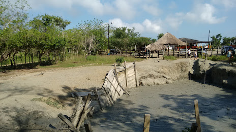
San Antero on the map, Colombia
Where is located San Antero
Exact location — San Antero, San Antero, Córdoba, Colombia, marked on the map with a red marker.
Coordinates
San Antero, Colombia coordinates in decimal format: latitude — 9.37419, longitude — -75.75913. When converted to degrees, minutes, seconds San Antero has the following coordinates: 9°22′27.08 north latitude and -75°45′32.87 east longitude.
Population
San Antero, San Antero, Córdoba, Colombia, according to our data the population is — 11,610 residents, which is about 0% of the total population of the country (Colombia).
Comparison of the population on the graph:
Exact time
Time zone for this location San Antero — UTC -5 America/Bogota. Exact time — monday, 4 april 2024 year, 11 h. 35 minutes.
Sunrise and sunset
San Antero, sunrise and sunset data for a date — monday 29.04.2024.
| Sunrise | Sunset | Day (duration) |
|---|---|---|
| 05:49 -0 minutes | 18:11 -0 minutes | 12 h. 24 minutes. -0 minutes |
You can control the scale of the map using the auxiliary tools to find out exactly where it is located San Antero. When you change the scale of the map, the width of the ruler also changes (in kilometers and miles).
Nearby cities
The largest cities that are located nearby:
- Sincelejo — 40 km
- Monteria — 70 km
- Magangué — 111 km
- Cartagena — 118 km
- Malambo — 196 km
- Soledad — 202 km
- Barranquilla — 205 km
- Santa Marta — 267 km
- Valledupar — 299 km
- Barrancabermeja — 330 km
- Bello — 337 km
- Medellín — 344 km
- Envigado — 354 km
- Itagüi — 355 km
- Bucaramanga — 381 km
- Giron — 381 km
- Floridablanca — 389 km
- Cúcuta — 393 km
- San Miguelito
 (Panama) — 408 km
Distance to neighboring capitals:
- Panama (Panama) — 415 km
- San Jose
 (Costa Rica) — 916 km
 - Caracas
 (Venezuela) — 975 km
 - Quito
 (Ecuador) — 1104 km
 - Georgetown
 (Guyana) — 1958 km
 - Nuestra Señora de La Paz
 (Bolivia) — 2997 km
 - Asuncion
 (Paraguay) — 4327 km
 - Santiago
 (Chile) — 4792 km
 - Buenos Aires
 (Argentina) — 5223 km
 - Montevideo
 (Uruguay) — 5339 km
Attractions
Distance to the capital
Distance to the capital (Bogota) is about — 563 km.