 Warner Robins
Wantagh
Bethel
Misty Hill Farm
United States
Wakonda Beach (R33) Airport
Wilmington
Poland
Miami International Airport
Warner Robins
Wantagh
Bethel
Misty Hill Farm
United States
Wakonda Beach (R33) Airport
Wilmington
Poland
Miami International Airport
Magnolia Park on the map, Beaverton, United States
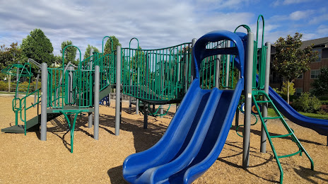
Photo
Where is located Magnolia Park
Magnolia Park — local attraction, which is located at 1810 NW 192nd Ave, Hillsboro, OR 97124, United States and belongs to the category — park. Average visitor rating for this place — 4.6 (according to 615 ratings, information from open sources and relevant for 2022).
Exact location — Magnolia Park, marked on the map with a red marker.
You can get directions to Magnolia Park on the map from your location.
What else is interesting in Beaverton? You can see all the sights if you go to the city page.
Coordinates
Magnolia Park, United States coordinates in decimal format: latitude — 45.532231558756955, longitude — -122.87265337489085. When converted to degrees, minutes, seconds Magnolia Park has the following coordinates: 45°31′56.03 north latitude and -122°52′21.55 east longitude.
Nearby cities
The largest cities that are located nearby:
- Portland — 11 km
- Vancouver — 20 km
- Salem — 63 km
- Eugene — 160 km
- Tacoma — 197 km
- Seattle — 237 km
- Bellevue — 239 km
- Victoria
 (Canada) — 328 km
 - Abbotsford (Canada) — 396 km
- Delta (Canada) — 399 km
- Richmond (Canada) — 408 km
- Surrey (Canada) — 409 km
- Burnaby (Canada) — 418 km
- Coquitlam (Canada) — 420 km
- Anmore (Canada) — 423 km
- Spokane — 467 km
- Kelowna (Canada) — 541 km
- Boise — 566 km
- Reno — 706 km
Distance to the capital
Distance to the capital (Washington) is about — 3794 km.