 Warner Robins
Wantagh
Bethel
Misty Hill Farm
United States
Wakonda Beach (R33) Airport
Wilmington
Poland
Miami International Airport
Warner Robins
Wantagh
Bethel
Misty Hill Farm
United States
Wakonda Beach (R33) Airport
Wilmington
Poland
Miami International Airport
Darien Park District on the map, Downers Grove, United States
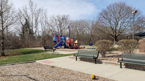
Photo
Where is located Darien Park District
Darien Park District — local attraction, which is located at 7301 Fairview Ave, Darien, IL 60561, United States and belongs to the category — park. Average visitor rating for this place — 4.2 (according to 100 ratings, information from open sources and relevant for 2022).
Exact location — Darien Park District, marked on the map with a red marker.
You can get directions to Darien Park District on the map from your location.
What else is interesting in Downers Grove? You can see all the sights if you go to the city page.
Coordinates
Darien Park District, United States coordinates in decimal format: latitude — 41.779724490717626, longitude — -88.00558173092857. When converted to degrees, minutes, seconds Darien Park District has the following coordinates: 41°46′47.01 north latitude and -88°0′20.09 east longitude.
Nearby cities
The largest cities that are located nearby:
- Naperville — 13 km
- Aurora — 26 km
- Joliet — 32 km
- Chicago — 32 km
- Rockford — 102 km
- Milwaukee — 136 km
- South Bend — 146 km
- Madison — 179 km
- Peoria — 181 km
- Grand Rapids — 229 km
- Fort Wayne — 253 km
- Indianapolis — 275 km
- Lansing — 299 km
- Green Bay — 300 km
- Ann Arbor — 353 km
- Toledo — 368 km
- Flint — 374 km
- Saint Louis — 399 km
- Detroit — 410 km
Distance to the capital
Distance to the capital (Washington) is about — 982 km.