 Warner Robins
Wantagh
Bethel
Misty Hill Farm
United States
Wakonda Beach (R33) Airport
Wilmington
Poland
Miami International Airport
Warner Robins
Wantagh
Bethel
Misty Hill Farm
United States
Wakonda Beach (R33) Airport
Wilmington
Poland
Miami International Airport
Humboldt Park on the map, Milwaukee, United States
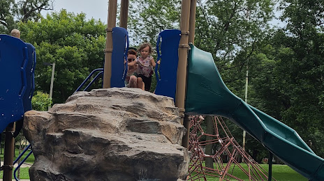
Photo
Where is located Humboldt Park
Humboldt Park — local attraction, which is located at 3000 S Howell Ave, Milwaukee, WI 53207, United States and belongs to the category — park. Average visitor rating for this place — 4.7 (according to 618 ratings, information from open sources and relevant for 2022).
Exact location — Humboldt Park, marked on the map with a red marker.
You can get directions to Humboldt Park on the map from your location.
What else is interesting in Milwaukee? You can see all the sights if you go to the city page.
Coordinates
Humboldt Park, United States coordinates in decimal format: latitude — 43.04351094944441, longitude — -87.97546739251374. When converted to degrees, minutes, seconds Humboldt Park has the following coordinates: 43°2′36.64 north latitude and -87°58′31.68 east longitude.
Nearby cities
The largest cities that are located nearby:
- Madison — 121 km
- Rockford — 129 km
- Chicago — 130 km
- Naperville — 144 km
- Aurora — 145 km
- Green Bay — 164 km
- Joliet — 168 km
- Grand Rapids — 181 km
- South Bend — 203 km
- Lansing — 274 km
- Peoria — 295 km
- Fort Wayne — 316 km
- Flint — 341 km
- Ann Arbor — 351 km
- Toledo — 390 km
- Indianapolis — 391 km
- Sterling Heights — 400 km
- Warren — 403 km
- Detroit — 405 km
Distance to the capital
Distance to the capital (Washington) is about — 1026 km.