 Warner Robins
Wantagh
Bethel
Misty Hill Farm
United States
Wakonda Beach (R33) Airport
Wilmington
Poland
Miami International Airport
Warner Robins
Wantagh
Bethel
Misty Hill Farm
United States
Wakonda Beach (R33) Airport
Wilmington
Poland
Miami International Airport
Dunham Park on the map, Sioux Falls, United States
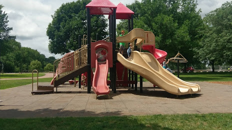
Photo
Where is located Dunham Park
Dunham Park — local attraction, which is located at 1301 S Marion Rd, Sioux Falls, SD 57106, United States and belongs to the category — park. Average visitor rating for this place — 4.3 (according to 313 ratings, information from open sources and relevant for 2022).
Exact location — Dunham Park, marked on the map with a red marker.
You can get directions to Dunham Park on the map from your location.
What else is interesting in Sioux Falls? You can see all the sights if you go to the city page.
Coordinates
Dunham Park, United States coordinates in decimal format: latitude — 43.53499567853951, longitude — -96.79481947495668. When converted to degrees, minutes, seconds Dunham Park has the following coordinates: 43°32′5.98 north latitude and -96°47′41.35 east longitude.
Nearby cities
The largest cities that are located nearby:
- Omaha — 261 km
- Lincoln — 301 km
- Minneapolis — 314 km
- Saint Paul — 325 km
- Des Moines — 336 km
- Topeka — 504 km
- North Kansas City — 521 km
- Kansas City — 525 km
- Independence — 531 km
- Overland Park — 535 km
- Olathe — 541 km
- Madison — 594 km
- Rockford — 640 km
- Wichita — 650 km
- Peoria — 677 km
- Green Bay — 695 km
- Winnipeg
 (Canada) — 703 km
 - Milwaukee — 715 km
- Aurora — 721 km
Distance to the capital
Distance to the capital (Washington) is about — 1726 km.