 Warner Robins
Wantagh
Bethel
Misty Hill Farm
United States
Wakonda Beach (R33) Airport
Wilmington
Poland
Miami International Airport
Warner Robins
Wantagh
Bethel
Misty Hill Farm
United States
Wakonda Beach (R33) Airport
Wilmington
Poland
Miami International Airport
Luna Rossa Winery on the map, Deming, United States
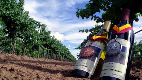
Photo
Where is located Luna Rossa Winery
Luna Rossa Winery — local attraction, which is located at 3710 W Pine St, Deming, NM 88030, United States and belongs to the category — winery. Average visitor rating for this place — 4.5 (according to 73 ratings, information from open sources and relevant for 2022).
Exact location — Luna Rossa Winery, marked on the map with a red marker.
You can get directions to Luna Rossa Winery on the map from your location.
What else is interesting in Deming? You can see all the sights if you go to the city page.
Coordinates
Luna Rossa Winery, United States coordinates in decimal format: latitude — 32.26299605544665, longitude — -107.81349257528149. When converted to degrees, minutes, seconds Luna Rossa Winery has the following coordinates: 32°15′46.79 north latitude and -107°48′48.57 east longitude.
Nearby cities
The largest cities that are located nearby:
- El Paso — 135 km
- Ciudad Juarez
 (Mexico) — 141 km
 - Valencia — 296 km
- Tucson — 296 km
- Nogales — 317 km
- Albuquerque — 328 km
- Gilbert — 391 km
- Chandler — 394 km
- Mesa — 397 km
- Tempe — 406 km
- Scottsdale — 407 km
- Phoenix — 419 km
- Glendale — 431 km
- Chihuahua (Mexico) — 434 km
- Peoria — 437 km
- Hermosillo (Mexico) — 469 km
- Delicias (Mexico) — 503 km
- Lubbock — 563 km
- Ciudad Obregón (Mexico) — 570 km
Distance to the capital
Distance to the capital (Washington) is about — 2865 km.