 Hobbs
Bethesda
Denver
Portland
Baton Rouge
Livonia
Skokie
Fort Collins
Grand Rapids
Norfolk
Winnebago
Palmer Lake
Englewood
Woodland Park
Scottsdale
Jackson
Eads
New Orleans
Colorado Springs
Hobbs
Bethesda
Denver
Portland
Baton Rouge
Livonia
Skokie
Fort Collins
Grand Rapids
Norfolk
Winnebago
Palmer Lake
Englewood
Woodland Park
Scottsdale
Jackson
Eads
New Orleans
Colorado Springs
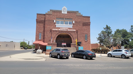
Deming on the map, United States
Where is located Deming
Exact location — Deming, Luna County, New Mexico, United States, marked on the map with a red marker.
Coordinates
Deming, United States coordinates in decimal format: latitude — 32.2686981, longitude — -107.7586404. When converted to degrees, minutes, seconds Deming has the following coordinates: 32°16′7.31 north latitude and -107°45′31.11 east longitude.
Population
Deming, Luna County, New Mexico, United States, according to our data the population is — 14,748 residents, which is about 0% of the total population of the country (United States).
Comparison of the population on the graph:
Exact time
Time zone for this location Deming — UTC -6 America/Denver. Exact time — friday, 4 april 2024 year, 17 h. 24 minutes.
Sunrise and sunset
Deming, sunrise and sunset data for a date — friday 26.04.2024.
| Sunrise | Sunset | Day (duration) |
|---|---|---|
| 06:31 -1 minute | 19:45 -0 minutes | 13 h. 12 minutes. +1 minute |
You can control the scale of the map using the auxiliary tools to find out exactly where it is located Deming. When you change the scale of the map, the width of the ruler also changes (in kilometers and miles).
Nearby cities
The largest cities that are located nearby:
- El Paso — 135 km
- Ciudad Juarez
 (Mexico) — 141 km
 - Valencia — 296 km
- Tucson — 296 km
- Nogales — 317 km
- Albuquerque — 328 km
- Gilbert — 391 km
- Chandler — 394 km
- Mesa — 397 km
- Tempe — 406 km
- Scottsdale — 407 km
- Phoenix — 419 km
- Glendale — 431 km
- Chihuahua (Mexico) — 434 km
- Peoria — 437 km
- Hermosillo (Mexico) — 469 km
- Delicias (Mexico) — 503 km
- Lubbock — 563 km
- Ciudad Obregón (Mexico) — 570 km
Distance to neighboring capitals:
- Mexico City (Mexico) — 1667 km
- Belmopan
 (Belize) — 2535 km
 - Guatemala City
 (Guatemala) — 2627 km
 - Ottawa
 (Canada) — 3110 km
 - Nuuk
 (Greenland) — 5189 km
Attractions


Distance to the capital
Distance to the capital (Washington) is about — 2860 km.