 Warner Robins
Wantagh
Bethel
Misty Hill Farm
United States
Wakonda Beach (R33) Airport
Wilmington
Poland
Miami International Airport
Warner Robins
Wantagh
Bethel
Misty Hill Farm
United States
Wakonda Beach (R33) Airport
Wilmington
Poland
Miami International Airport
Thermal valley Hang Gliding on the map, Morganton, United States
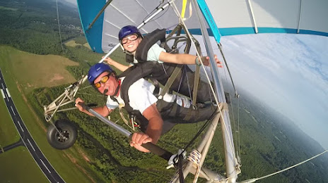
Photo
Where is located Thermal valley Hang Gliding
Thermal valley Hang Gliding — local attraction, which is located at 4098 Old Amherst Rd, Lenoir, NC 28645, United States and belongs to the category — hang gliding center. Average visitor rating for this place — 4.9 (according to 38 ratings, information from open sources and relevant for 2022).
Exact location — Thermal valley Hang Gliding, marked on the map with a red marker.
You can get directions to Thermal valley Hang Gliding on the map from your location.
What else is interesting in Morganton? You can see all the sights if you go to the city page.
Coordinates
Thermal valley Hang Gliding, United States coordinates in decimal format: latitude — 35.82430683418781, longitude — -81.60294137518785. When converted to degrees, minutes, seconds Thermal valley Hang Gliding has the following coordinates: 35°49′27.5 north latitude and -81°36′10.59 east longitude.
Nearby cities
The largest cities that are located nearby:
- Charlotte — 95 km
- Winston-Salem — 135 km
- Greensboro — 173 km
- Knoxville — 202 km
- Columbia — 202 km
- Durham — 251 km
- Cary — 260 km
- Fayetteville — 265 km
- Raleigh — 273 km
- Atlanta — 332 km
- Chattanooga — 337 km
- Charleston — 367 km
- Savannah — 409 km
- Richmond — 422 km
- Cincinnati — 443 km
- Louisville — 449 km
- Nashville — 457 km
- Huntsville — 459 km
- Columbus — 479 km
Distance to the capital
Distance to the capital (Washington) is about — 529 km.