 Warner Robins
Wantagh
Bethel
Misty Hill Farm
United States
Wakonda Beach (R33) Airport
Wilmington
Poland
Miami International Airport
Warner Robins
Wantagh
Bethel
Misty Hill Farm
United States
Wakonda Beach (R33) Airport
Wilmington
Poland
Miami International Airport
Old School Forest Preserve on the map, Libertyville, United States
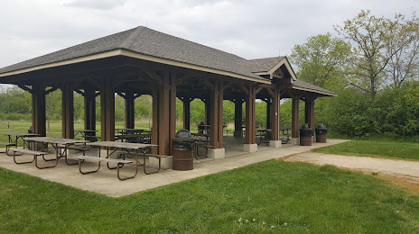
Photo
Where is located Old School Forest Preserve
Old School Forest Preserve — local attraction, which is located at 28285 N St Marys Rd, Libertyville, IL 60048, United States and belongs to the category — nature preserve. Average visitor rating for this place — 4.7 (according to 508 ratings, information from open sources and relevant for 2022).
Exact location — Old School Forest Preserve, marked on the map with a red marker.
You can get directions to Old School Forest Preserve on the map from your location.
What else is interesting in Libertyville? You can see all the sights if you go to the city page.
Coordinates
Old School Forest Preserve, United States coordinates in decimal format: latitude — 42.27207925416043, longitude — -87.92377337499707. When converted to degrees, minutes, seconds Old School Forest Preserve has the following coordinates: 42°16′19.49 north latitude and -87°55′25.58 east longitude.
Nearby cities
The largest cities that are located nearby:
- Chicago — 52 km
- Naperville — 61 km
- Aurora — 65 km
- Milwaukee — 84 km
- Joliet — 84 km
- Rockford — 93 km
- Madison — 146 km
- South Bend — 156 km
- Grand Rapids — 200 km
- Peoria — 223 km
- Green Bay — 247 km
- Fort Wayne — 270 km
- Lansing — 280 km
- Indianapolis — 317 km
- Ann Arbor — 344 km
- Flint — 354 km
- Toledo — 370 km
- Detroit — 401 km
- Windsor
 (Canada) — 402 km
Distance to the capital
Distance to the capital (Washington) is about — 992 km.