 Warner Robins
Wantagh
Bethel
Misty Hill Farm
United States
Wakonda Beach (R33) Airport
Wilmington
Poland
Miami International Airport
Warner Robins
Wantagh
Bethel
Misty Hill Farm
United States
Wakonda Beach (R33) Airport
Wilmington
Poland
Miami International Airport
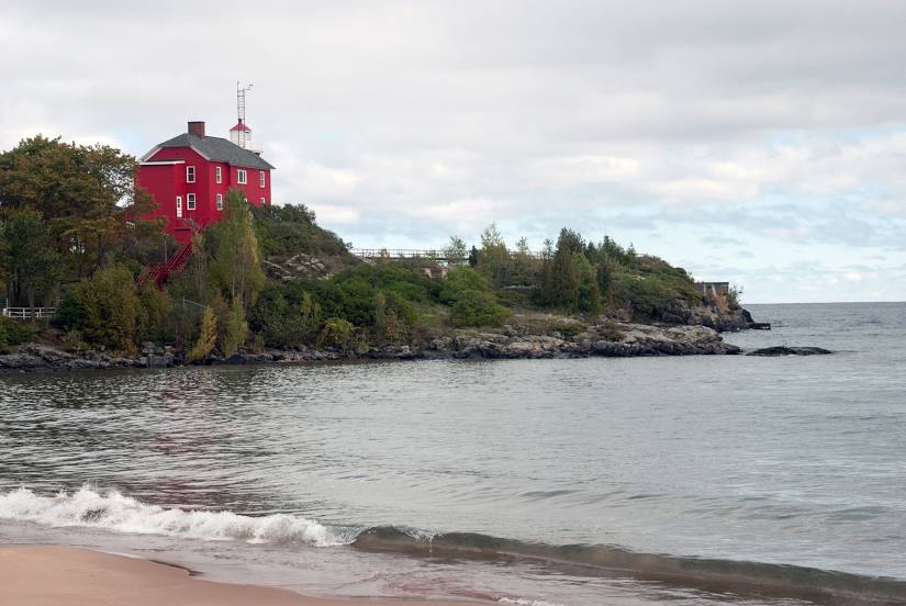
Marquette Harbor Lighthouse on the map, Marquette, United States
Photo
Where is located Marquette Harbor Lighthouse
Marquette Harbor Lighthouse — local attraction, which is located at 300 N Lakeshore Blvd, Marquette, MI 49855, United States and belongs to the category — lighthouse. Average visitor rating for this place — 4.7 (according to 274 ratings, information from open sources and relevant for 2022).
Exact location — Marquette Harbor Lighthouse, marked on the map with a red marker.
You can get directions to Marquette Harbor Lighthouse on the map from your location.
What else is interesting in Marquette? You can see all the sights if you go to the city page.
Coordinates
Marquette Harbor Lighthouse, United States coordinates in decimal format: latitude — 46.54652967399548, longitude — -87.37635837485652. When converted to degrees, minutes, seconds Marquette Harbor Lighthouse has the following coordinates: 46°32′47.51 north latitude and -87°22′34.89 east longitude.
Nearby cities
The largest cities that are located nearby:
- Green Bay — 230 km
- Milwaukee — 390 km
- Madison — 417 km
- Grand Rapids — 420 km
- Saint Paul — 479 km
- Lansing — 481 km
- Minneapolis — 491 km
- Flint — 493 km
- Rockford — 493 km
- Chicago — 517 km
- Naperville — 534 km
- Aurora — 535 km
- South Bend — 547 km
- Joliet — 558 km
- Ann Arbor — 558 km
- Sterling Heights — 565 km
- Warren — 571 km
- Detroit — 586 km
- Windsor
 (Canada) — 588 km
Distance to the capital
Distance to the capital (Washington) is about — 1196 km.