 Warner Robins
Wantagh
Bethel
Misty Hill Farm
United States
Wakonda Beach (R33) Airport
Wilmington
Poland
Miami International Airport
Warner Robins
Wantagh
Bethel
Misty Hill Farm
United States
Wakonda Beach (R33) Airport
Wilmington
Poland
Miami International Airport
Woodland Dunes State Natural Area on the map, Manitowoc, United States
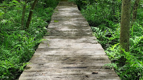
Photo
Where is located Woodland Dunes State Natural Area
Woodland Dunes State Natural Area — local attraction, which is located at Two Rivers, WI 54241, United States and belongs to the category — nature preserve. Average visitor rating for this place — 4.6 (according to 47 ratings, information from open sources and relevant for 2022).
Exact location — Woodland Dunes State Natural Area, marked on the map with a red marker.
You can get directions to Woodland Dunes State Natural Area on the map from your location.
What else is interesting in Manitowoc? You can see all the sights if you go to the city page.
Coordinates
Woodland Dunes State Natural Area, United States coordinates in decimal format: latitude — 44.14451813426755, longitude — -87.60142117493683. When converted to degrees, minutes, seconds Woodland Dunes State Natural Area has the following coordinates: 44°8′40.27 north latitude and -87°36′5.12 east longitude.
Nearby cities
The largest cities that are located nearby:
- Green Bay — 56 km
- Milwaukee — 118 km
- Madison — 180 km
- Grand Rapids — 203 km
- Rockford — 233 km
- Chicago — 244 km
- Naperville — 262 km
- Aurora — 263 km
- Joliet — 286 km
- South Bend — 291 km
- Lansing — 293 km
- Flint — 342 km
- Ann Arbor — 377 km
- Fort Wayne — 393 km
- Peoria — 409 km
- Sterling Heights — 412 km
- Warren — 416 km
- Detroit — 424 km
- Windsor
 (Canada) — 426 km
Distance to the capital
Distance to the capital (Washington) is about — 1054 km.