 Warner Robins
Wantagh
Bethel
Misty Hill Farm
United States
Wakonda Beach (R33) Airport
Wilmington
Poland
Miami International Airport
Warner Robins
Wantagh
Bethel
Misty Hill Farm
United States
Wakonda Beach (R33) Airport
Wilmington
Poland
Miami International Airport
Brevard County Enchanted Forest Sanctuary on the map, Titusville, United States
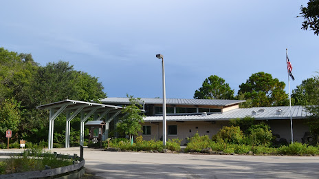
Photo
Where is located Brevard County Enchanted Forest Sanctuary
Brevard County Enchanted Forest Sanctuary — local attraction, which is located at 444 Columbia Blvd, Titusville, FL 32780, United States and belongs to the category — county government office. Average visitor rating for this place — 4.8 (according to 174 ratings, information from open sources and relevant for 2022).
Exact location — Brevard County Enchanted Forest Sanctuary, marked on the map with a red marker.
You can get directions to Brevard County Enchanted Forest Sanctuary on the map from your location.
What else is interesting in Titusville? You can see all the sights if you go to the city page.
Coordinates
Brevard County Enchanted Forest Sanctuary, United States coordinates in decimal format: latitude — 28.533193466738627, longitude — -80.8025229753702. When converted to degrees, minutes, seconds Brevard County Enchanted Forest Sanctuary has the following coordinates: 28°31′59.5 north latitude and -80°48′9.08 east longitude.
Nearby cities
The largest cities that are located nearby:
- Orlando — 56 km
- Port Saint Lucie — 155 km
- Brandon — 163 km
- Tampa — 177 km
- Gainesville — 186 km
- Saint Petersburg — 202 km
- Jacksonville — 207 km
- Clearwater — 207 km
- Cape Coral — 253 km
- Coral Springs — 264 km
- Fort Lauderdale — 283 km
- Pembroke Pines — 292 km
- Miramar — 295 km
- Hollywood — 295 km
- Hialeah — 309 km
- Miami — 321 km
- Savannah — 385 km
- Tallahassee — 388 km
- Charleston — 468 km
Distance to the capital
Distance to the capital (Washington) is about — 1205 km.