 Warner Robins
Wantagh
Bethel
Misty Hill Farm
United States
Wakonda Beach (R33) Airport
Wilmington
Poland
Miami International Airport
Warner Robins
Wantagh
Bethel
Misty Hill Farm
United States
Wakonda Beach (R33) Airport
Wilmington
Poland
Miami International Airport
Tam O'Shanter Park on the map, Massillon, United States
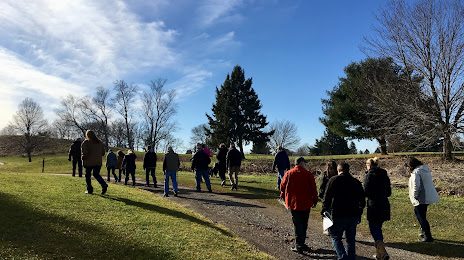
Photo
Where is located Tam O'Shanter Park
Tam O'Shanter Park — local attraction, which is located at 5055 Hills and Dales Rd NW, Canton, OH 44708, United States and belongs to the category — park. Average visitor rating for this place — 4.6 (according to 98 ratings, information from open sources and relevant for 2022).
Exact location — Tam O'Shanter Park, marked on the map with a red marker.
You can get directions to Tam O'Shanter Park on the map from your location.
What else is interesting in Massillon? You can see all the sights if you go to the city page.
Coordinates
Tam O'Shanter Park, United States coordinates in decimal format: latitude — 40.834484050781704, longitude — -81.44156247504188. When converted to degrees, minutes, seconds Tam O'Shanter Park has the following coordinates: 40°50′4.14 north latitude and -81°26′29.62 east longitude.
Nearby cities
The largest cities that are located nearby:
- Akron — 31 km
- Aurora — 59 km
- Cleveland — 79 km
- Pittsburgh — 134 km
- Columbus — 156 km
- Toledo — 193 km
- Windsor
 (Canada) — 209 km
 - Detroit — 211 km
- Springfield — 217 km
- Warren — 226 km
- Sterling Heights — 232 km
- London (Canada) — 243 km
- Ann Arbor — 245 km
- Cambridge (Canada) — 300 km
- Flint — 301 km
- Kitchener (Canada) — 301 km
- Hamilton (Canada) — 302 km
- Fort Wayne — 303 km
- Boston — 304 km
Distance to the capital
Distance to the capital (Washington) is about — 433 km.