 Warner Robins
Wantagh
Bethel
Misty Hill Farm
United States
Wakonda Beach (R33) Airport
Wilmington
Poland
Miami International Airport
Warner Robins
Wantagh
Bethel
Misty Hill Farm
United States
Wakonda Beach (R33) Airport
Wilmington
Poland
Miami International Airport
Ionia State Recreation Area on the map, Ionia, United States
Photo
Where is located Ionia State Recreation Area
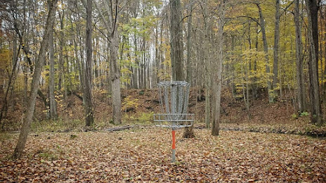
Ionia State Recreation Area — local attraction, which is located at 2880 W David Hwy, Saranac, MI 48881, United States and belongs to the category — state park. Average visitor rating for this place — 4.4 (according to 61 rating, information from open sources and relevant for 2022).
Exact location — Ionia State Recreation Area, marked on the map with a red marker.
You can get directions to Ionia State Recreation Area on the map from your location.
What else is interesting in Ionia? You can see all the sights if you go to the city page.
Coordinates
Ionia State Recreation Area, United States coordinates in decimal format: latitude — 42.93469863207611, longitude — -85.134187174976. When converted to degrees, minutes, seconds Ionia State Recreation Area has the following coordinates: 42°56′4.92 north latitude and -85°8′3.07 east longitude.
Nearby cities
The largest cities that are located nearby:
- Grand Rapids — 48 km
- Lansing — 50 km
- Flint — 112 km
- Ann Arbor — 134 km
- Sterling Heights — 172 km
- South Bend — 175 km
- Warren — 176 km
- Detroit — 181 km
- Windsor
 (Canada) — 182 km
 - Toledo — 193 km
- Fort Wayne — 211 km
- Milwaukee — 229 km
- Chicago — 244 km
- Green Bay — 288 km
- Naperville — 289 km
- Joliet — 297 km
- Aurora — 300 km
- London (Canada) — 310 km
- Cleveland — 324 km
Distance to the capital
Distance to the capital (Washington) is about — 814 km.