 Warner Robins
Wantagh
Bethel
Misty Hill Farm
United States
Wakonda Beach (R33) Airport
Wilmington
Poland
Miami International Airport
Warner Robins
Wantagh
Bethel
Misty Hill Farm
United States
Wakonda Beach (R33) Airport
Wilmington
Poland
Miami International Airport
Red Mill County Park on the map, Michigan City, United States
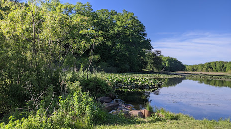
Photo
Where is located Red Mill County Park
Red Mill County Park — local attraction, which is located at 0185 S Holmesville Rd, La Porte, IN 46350, United States and belongs to the category — park. Average visitor rating for this place — 4.7 (according to 183 ratings, information from open sources and relevant for 2022).
Exact location — Red Mill County Park, marked on the map with a red marker.
You can get directions to Red Mill County Park on the map from your location.
What else is interesting in Michigan City? You can see all the sights if you go to the city page.
Coordinates
Red Mill County Park, United States coordinates in decimal format: latitude — 41.603140177498666, longitude — -86.88054577501808. When converted to degrees, minutes, seconds Red Mill County Park has the following coordinates: 41°36′11.3 north latitude and -86°52′49.96 east longitude.
Nearby cities
The largest cities that are located nearby:
- South Bend — 53 km
- Chicago — 63 km
- Joliet — 100 km
- Naperville — 104 km
- Aurora — 118 km
- Fort Wayne — 162 km
- Milwaukee — 168 km
- Grand Rapids — 171 km
- Rockford — 190 km
- Lansing — 221 km
- Indianapolis — 223 km
- Peoria — 252 km
- Madison — 253 km
- Ann Arbor — 266 km
- Toledo — 276 km
- Flint — 297 km
- Detroit — 322 km
- Windsor
 (Canada) — 323 km
 - Green Bay — 323 km
Distance to the capital
Distance to the capital (Washington) is about — 887 km.