 Warner Robins
Wantagh
Bethel
Misty Hill Farm
United States
Wakonda Beach (R33) Airport
Wilmington
Poland
Miami International Airport
Warner Robins
Wantagh
Bethel
Misty Hill Farm
United States
Wakonda Beach (R33) Airport
Wilmington
Poland
Miami International Airport
Samish Island, Washington on the map, Anacortes, United States
Photo
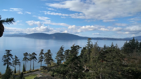
Where is located Samish Island, Washington
Samish Island, Washington — local attraction, which is located at no data and belongs to the category — -. Average visitor rating for this place — 4.6 (according to 26 ratings, information from open sources and relevant for 2022).
Exact location — Samish Island, Washington, marked on the map with a red marker.
You can get directions to Samish Island, Washington on the map from your location.
What else is interesting in Anacortes? You can see all the sights if you go to the city page.
Coordinates
Samish Island, Washington, United States coordinates in decimal format: latitude — 48.57568197654812, longitude — -122.54151819777532. When converted to degrees, minutes, seconds Samish Island, Washington has the following coordinates: 48°34′32.46 north latitude and -122°32′29.47 east longitude.
Nearby cities
The largest cities that are located nearby:
- Victoria
 (Canada) — 56 km
 - Abbotsford (Canada) — 63 km
- Delta (Canada) — 71 km
- Surrey (Canada) — 76 km
- Richmond (Canada) — 82 km
- Coquitlam (Canada) — 86 km
- Burnaby (Canada) — 87 km
- Anmore (Canada) — 90 km
- Vancouver (Canada) — 93 km
- Seattle — 102 km
- Bellevue — 104 km
- Tacoma — 140 km
- Kelowna (Canada) — 269 km
- Portland — 331 km
- Salem — 396 km
- Spokane — 398 km
- Eugene — 495 km
- Calgary (Canada) — 657 km
- Boise — 745 km
Distance to the capital
Distance to the capital (Washington) is about — 3750 km.