
 Puerto de la Duquesa
La Serna de Iguña
Pumalverde
Puentenansa
La Iglesia
Casar de Periedo
Fuengirola
Renedo de Piélagos
Villabanez
Puerto de la Duquesa
La Serna de Iguña
Pumalverde
Puentenansa
La Iglesia
Casar de Periedo
Fuengirola
Renedo de Piélagos
Villabanez
Barranc de l'Infern (Marina Alta) on the map, Pego, Spain
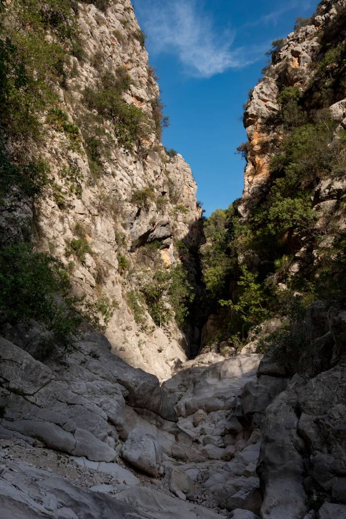
Photo
Where is located Barranc de l'Infern (Marina Alta)
Barranc de l'Infern (Marina Alta) — local attraction, which is located at Alicante and belongs to the category — -. Average visitor rating for this place — 4.8 (according to 187 ratings, information from open sources and relevant for 2022).
Exact location — Barranc de l'Infern (Marina Alta), marked on the map with a red marker.
You can get directions to Barranc de l'Infern (Marina Alta) on the map from your location.
What else is interesting in Pego? You can see all the sights if you go to the city page.
Coordinates
Barranc de l'Infern (Marina Alta), Spain coordinates in decimal format: latitude — 38.789719069715126, longitude — -0.1107739560133761. When converted to degrees, minutes, seconds Barranc de l'Infern (Marina Alta) has the following coordinates: 38°47′22.99 north latitude and -0°6′38.79 east longitude.
Nearby cities
The largest cities that are located nearby:
- Valencia — 73 km
- Murcia — 129 km
- Albacete — 151 km
- Cartagena — 155 km
- Palma — 249 km
- Tarragona — 276 km
- Almería — 304 km
- Lleida — 313 km
- Zaragoza — 317 km
- Chlef
 (Algeria) — 323 km
 - Alcala de Henares — 328 km
- Torrejón de Ardoz — 334 km
- L'Hospitalet de Llobregat — 335 km
- Jaén — 342 km
- Getafe — 345 km
- Santa Coloma de Gramenet — 346 km
- Badalona — 348 km
- Terrassa — 348 km
- Relizane (Algeria) — 349 km
Distance to the capital
Distance to the capital (Madrid) is about — 357 km.