
 Maureville
Samoëns
Gréning
Toulouse
Volx
Goudet
Méhoncourt
Saint-Hymer
Pontcarré
Maureville
Samoëns
Gréning
Toulouse
Volx
Goudet
Méhoncourt
Saint-Hymer
Pontcarré
Ponts-Jumeaux on the map, Toulouse, France
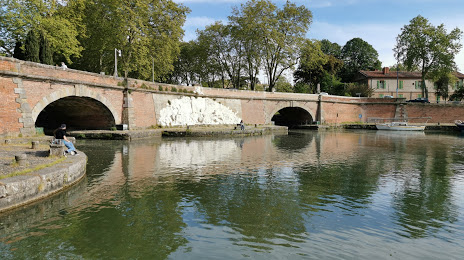
Photo
Where is located Ponts-Jumeaux
Ponts-Jumeaux — local attraction, which is located at Les Ponts Jumeaux, 31200 Toulouse, France and belongs to the category — bridge. Average visitor rating for this place — 4.4 (according to 122 ratings, information from open sources and relevant for 2022).
Exact location — Ponts-Jumeaux, marked on the map with a red marker.
You can get directions to Ponts-Jumeaux on the map from your location.
What else is interesting in Toulouse? You can see all the sights if you go to the city page.
Coordinates
Ponts-Jumeaux, France coordinates in decimal format: latitude — 43.613339188557816, longitude — 1.4218254460087139. When converted to degrees, minutes, seconds Ponts-Jumeaux has the following coordinates: 43°36′48.02 north latitude and 1°25′18.57 east longitude.
Nearby cities
The largest cities that are located nearby:
- Perpignan — 155 km
- Montpellier — 195 km
- Bordeaux — 209 km
- Lleida
 (Spain) — 230 km
 - Terrassa (Spain) — 230 km
- Nimes — 234 km
- Sabadell (Spain) — 234 km
- Mataró (Spain) — 243 km
- Limoges — 247 km
- Santa Coloma de Gramenet (Spain) — 247 km
- Badalona (Spain) — 248 km
- L'Hospitalet de Llobregat (Spain) — 254 km
- Pamplona (Spain) — 265 km
- Clermont-Ferrand — 272 km
- Tarragona (Spain) — 275 km
- San Sebastián (Spain) — 277 km
- Zaragoza (Spain) — 290 km
- Saint-Étienne — 305 km
- Marseille — 318 km
Distance to the capital
Distance to the capital (Paris) is about — 588 km.