
 Maureville
Samoëns
Gréning
Toulouse
Volx
Goudet
Méhoncourt
Saint-Hymer
Pontcarré
Maureville
Samoëns
Gréning
Toulouse
Volx
Goudet
Méhoncourt
Saint-Hymer
Pontcarré
Planetarium on the map, Nantes, France
Photo
Where is located Planetarium
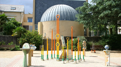
Planetarium — local attraction, which is located at 8 Rue des Acadiens, 44100 Nantes, France and belongs to the category — planetarium. Average visitor rating for this place — 4.3 (according to 59 ratings, information from open sources and relevant for 2022).
Exact location — Planetarium, marked on the map with a red marker.
You can get directions to Planetarium on the map from your location.
What else is interesting in Nantes? You can see all the sights if you go to the city page.
Coordinates
Planetarium, France coordinates in decimal format: latitude — 47.20220243261434, longitude — -1.5775392749286332. When converted to degrees, minutes, seconds Planetarium has the following coordinates: 47°12′7.93 north latitude and -1°34′39.14 east longitude.
Nearby cities
The largest cities that are located nearby:
- Angers — 79 km
- Rennes — 100 km
- Le Mans — 156 km
- Tours — 169 km
- Caen — 233 km
- Brest — 251 km
- Limoges — 265 km
- Orléans — 268 km
- Bordeaux — 274 km
- Le Havre — 278 km
- Rouen — 311 km
- Boulogne-Billancourt — 329 km
- Bournemouth
 (United Kingdom) — 388 km
 - Clermont-Ferrand — 392 km
- Portsmouth (United Kingdom) — 399 km
- Amiens — 403 km
- Southampton (United Kingdom) — 408 km
- Exeter (United Kingdom) — 411 km
- Eastbourne (United Kingdom) — 413 km
Distance to the capital
Distance to the capital (Paris) is about — 345 km.